Skip Navigation Links weather.gov 
NOAA logo-Select to go to the NOAA homepage NOAA's National Weather Service   Select to go to the NWS homepage
Storm Prediction Center
navigation bar left  
  navigation bar end cap


USA.gov is the U.S. Government's official Web portal to all Federal, state and local government Web resources and services.

Mesoscale Discussion 1582
< Previous MD         Next MD >
MD 1582 graphic
   
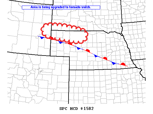
   MESOSCALE DISCUSSION 1582
   NWS STORM PREDICTION CENTER NORMAN OK
   0501 PM CDT MON JUL 11 2011
   
   AREAS AFFECTED...EXTREME ERN WY...NRN NEB AND SWRN SD
   
   CONCERNING...SEVERE POTENTIAL...WATCH NEEDED SOON 
   
   VALID 112201Z - 112230Z
   
   ENVIRONMENTAL CONDITIONS HAVE BECOME MORE FAVORABLE FOR ISOLATED
   TORNADOES ALONG AND NORTH OF A QUASISTATIONARY FRONT FROM EXTREME
   E-CNTRL WY...NRN NEB INTO SWRN SD...AND A WATCH ISSUANCE HAS BEEN
   COORDINATED AND WILL BE ISSUED SOON.
   
   ..DIAL.. 07/11/2011
   
   
   ATTN...WFO...LBF...UNR...CYS...
   
   LAT...LON   43380440 43030072 42390047 42200122 42380318 42660476
               43380440 
   
Top/All Mesoscale Discussions/Forecast Products/Home
Weather Topics:
Watches, Mesoscale Discussions, Outlooks, Fire Weather, All Products, Contact Us

NOAA / National Weather Service
National Centers for Environmental Prediction
Storm Prediction Center
120 David L. Boren Blvd.
Norman, OK 73072 U.S.A.
spc.feedback@noaa.gov
Page last modified: January 01, 1970
Disclaimer
Information Quality
Help
Glossary
Privacy Policy
Freedom of Information Act (FOIA)
About Us
Career Opportunities