|
| Mesoscale Discussion 421 |
|
< Previous MD Next MD >
|
|
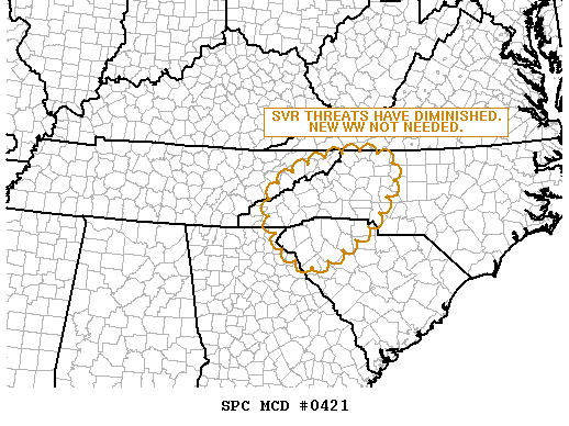
   MESOSCALE DISCUSSION 0421
   NWS STORM PREDICTION CENTER NORMAN OK
   0139 AM CDT TUE APR 12 2011

   AREAS AFFECTED...FAR ERN TN...WRN NC...UPSTATE SC...EXTREME NERN GA

   CONCERNING...TORNADO WATCH 132...

   VALID 120639Z - 120715Z

   THE SEVERE WEATHER THREAT FOR TORNADO WATCH 132 CONTINUES.

   ...SEVERE THREATS HAVE DIMINISHED...

   TORNADO WATCH 132 EXPIRES AT 07Z AND THERE ARE NO PLANS TO ISSUE A
   NEW WATCH.

   BAND OF TSTMS DIMINISHED AS IT CROSSED THE APPALACHIAN CREST AND
   INSPECTION OF DOWNSTREAM RUC SOUNDINGS IN THE FOOTHILLS OF NC/SC
   EXHIBIT A WARM LAYER ALOFT AND LITTLE BUOYANCY.  AS A RESULT...THERE
   IS NO REASON TO BELIEVE THAT STORMS WILL INCREASE IN INTENSITY FOR
   THE REMAINDER OF THE NIGHT.

   ..RACY.. 04/12/2011


   ATTN...WFO...RAH...RNK...GSP...MRX...

   LAT...LON   34578316 35498355 36178284 36568123 36238034 35438066
               34858123 34248223 34278269 34578316
|
|
Top/All Mesoscale Discussions/Forecast Products/Home
|
|


 @NWSSPC