ZCZC SPCFWDDY1 ALL
FNUS21 KWNS 020657
Day 1 Fire Weather Outlook
NWS Storm Prediction Center Norman OK
0157 AM CDT Thu May 02 2024
Valid 021200Z - 031200Z
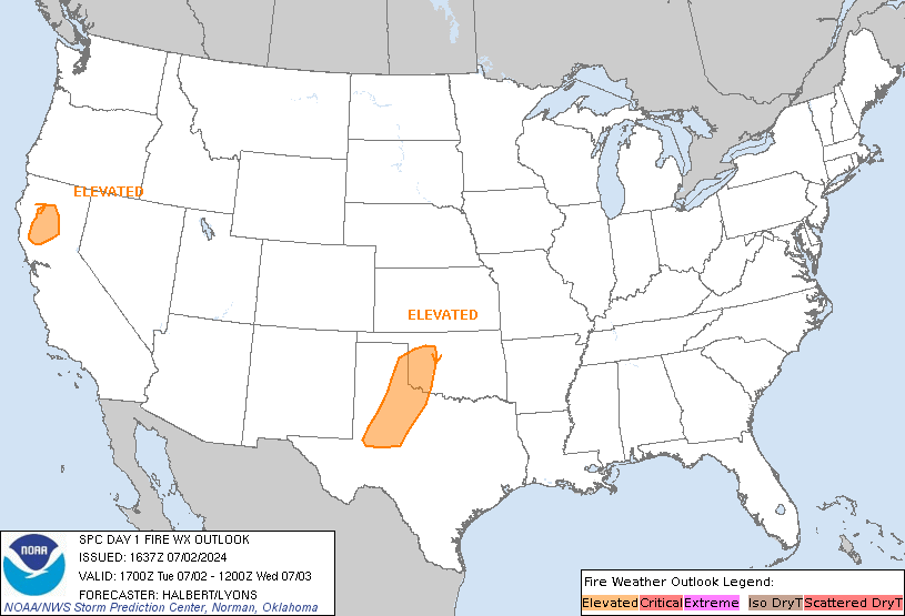
...Synopsis...
Northwesterly flow is expected to strengthen across New Mexico
today, as a lee cyclone develops in the southern High Plains.
Sustained winds of 15 to 20 mph are expected with relative humidity
in the single digits. Coverage of critical winds speeds still
appears too localized at this time to introduce a Critical area. As
such, the Elevated was maintained with this outlook, as it covers
the threat sufficiently. Locally Critical conditions will be
possible, mainly in the lee of terrain features.
..Thornton.. 05/02/2024
...Please see www.spc.noaa.gov/fire for graphic product...
CLICK FOR DAY 1 FIREWX AREAL OUTLINE PRODUCT (KWNSPFWFD1)


 @NWSSPC
