(All days are valid from 12 UTC - 12 UTC the following day)
Note: A severe weather area depicted in the Day 4-8 period indicates 15%, 30% or higher probability for severe thunderstorms within 25 miles of any point.
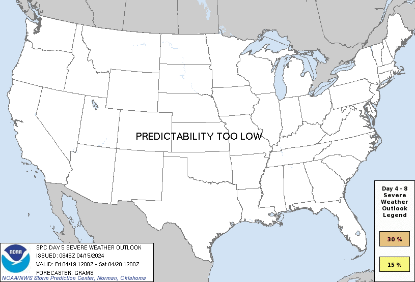
PREDICTABILITY TOO LOW is used to indicate severe storms may be possible based on some model scenarios. However, the location or occurrence of severe storms are in doubt due to: 1) large differences in the deterministic model solutions, 2) large spread in the ensemble guidance, and/or 3) minimal run-to-run continuity.
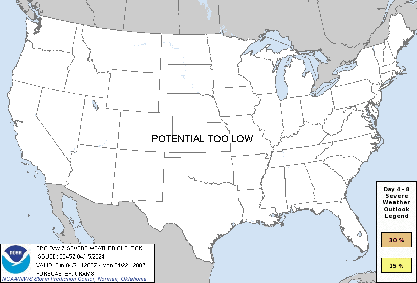
POTENTIAL TOO LOW means the threat for a regional area of organized severe storms appears unlikely (i.e., less than 15%) for the forecast day.
Forecast Discussion
ZCZC SPCSWOD48 ALL
ACUS48 KWNS 150845
SPC AC 150845
Day 4-8 Convective Outlook
NWS Storm Prediction Center Norman OK
0345 AM CDT Mon Apr 15 2024
Valid 181200Z - 231200Z
...DISCUSSION...
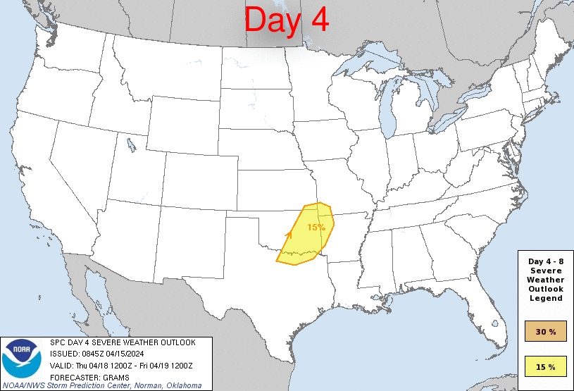
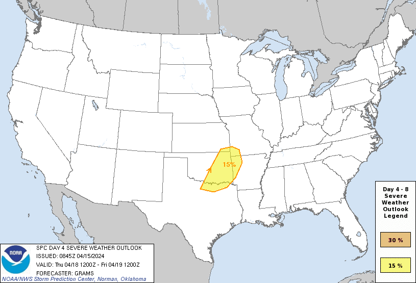
Isolated to scattered large hail and isolated severe wind gusts are
evident on D4/Thursday from the Ozark Plateau into central TX. Low
probability severe may persist into D5-6, mainly across parts of TX,
with severe potential appearing negligible around D7-8.
A northern-stream mid/upper trough should shift east from the
Northwest into the Upper Midwest on D4. A more piecemeal eastward
evolution is progged into the weekend amid multiple embedded
impulses. The southern stream is expected to remain relatively weak
and quasi-zonal, although there are indications of lower-amplitude
impulses migrating through the flow.
The best potential for severe appears focused on D4. Both the 00Z
NAM/ECMWF hint at elevated convection developing across the central
Great Plains late D3 on Thursday morning within a strengthening
low-level warm theta-e advection regime south of the trough shifting
into the Upper Midwest. Robust diabatic heating is expected in the
warm-moist sector over the southern Great Plains, with the largest
buoyancy so far this week ahead of the dryline in TX.
As surface ridging noses down the High Plains, a lee cyclone will be
forced east-southeast into OK as a developing frontal wave.
Above-average agreement exists across guidance with surface-based
convective development along both the southwest/northeast-oriented
baroclinic zone and dryline. Primary uncertainty with southern
extent is the degree of deep-layer shear as wind profiles appear
weak to modest over most of the larger buoyancy plume. Have
delineated a 15 percent area where potential for a few supercells
and multicell clusters is evident on Thursday afternoon, with an
implied lower severe probability extending farther southwest through
much of central TX.
..Grams.. 04/15/2024
CLICK TO GET WUUS48 PTSD48 PRODUCT


 @NWSSPC