(All days are valid from 12 UTC - 12 UTC the following day)
Note: A severe weather area depicted in the Day 4-8 period indicates 15%, 30% or higher probability for severe thunderstorms within 25 miles of any point.
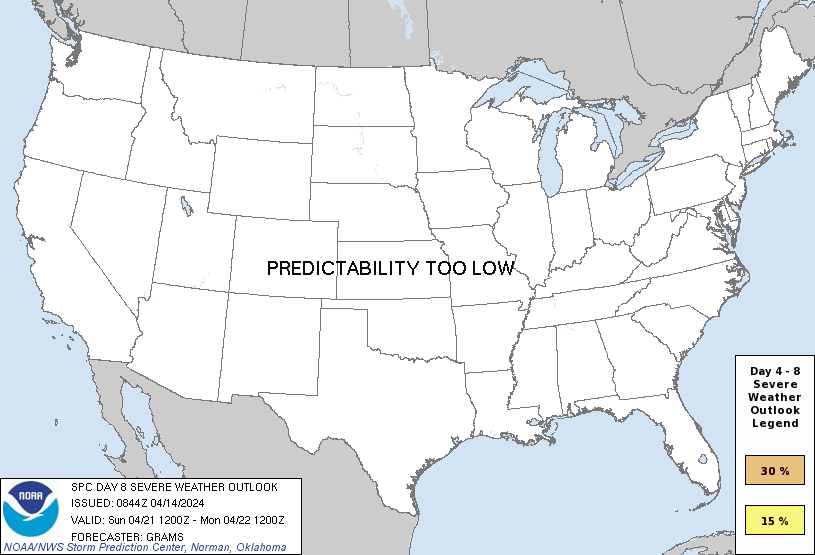
PREDICTABILITY TOO LOW is used to indicate severe storms may be possible based on some model scenarios. However, the location or occurrence of severe storms are in doubt due to: 1) large differences in the deterministic model solutions, 2) large spread in the ensemble guidance, and/or 3) minimal run-to-run continuity.
POTENTIAL TOO LOW means the threat for a regional area of organized severe storms appears unlikely (i.e., less than 15%) for the forecast day.
Forecast Discussion
ZCZC SPCSWOD48 ALL
ACUS48 KWNS 140844
SPC AC 140844
Day 4-8 Convective Outlook
NWS Storm Prediction Center Norman OK
0344 AM CDT Sun Apr 14 2024
Valid 171200Z - 221200Z
...DISCUSSION...
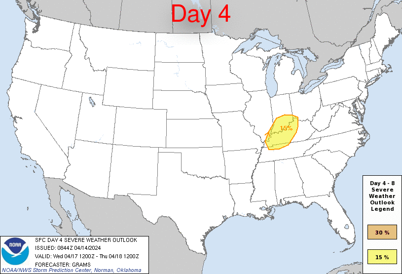
...D4/Wednesday...
Guidance continues to suggest some severe threat will persist into
Wednesday afternoon given the strength of low to mid-level flow
before the Upper MS Valley surface cyclone further occludes and
dampens over the western to central Great Lakes. The northeast lobe
of the warm-moist sector emanating from the western Gulf should be
more confined relative to D3/Tuesday. Thus, have only delineated a
small 15 percent highlight where consensus of guidance suggests the
best potential for daytime destabilization will overlap with the
stronger low to deep-layer flow. Low severe probabilities are
evident surrounding the highlight, both farther south-southwestward
in the TN Valley/Mid-South and northeastward deeper into IN/OH.
...D5-8/Thursday-Sunday...
A broad mid/upper trough is still advertised to become established
over the Upper Midwest by about D5, with predictability waning in
its evolution into next weekend. This should yield surface high
pressure/ridging being periodically reinforced from at least the
northern High Plains into the central Great Plains. Within the
predominantly westerly mid-level flow regime across the rich
warm-moist sector, an elevated mixed layer should support at least
moderate buoyancy over parts of the TX/OK/AR/LA region. The
quasi-stationary baroclinic zone should eventually be pushed south
towards the northwest Gulf around next weekend. This overall setup
may support daily bouts of low-probability severe.
..Grams.. 04/14/2024
CLICK TO GET WUUS48 PTSD48 PRODUCT


 @NWSSPC