Day 4-8 Severe Weather Outlook Issued on Apr 13, 2024
Updated: Sat Apr 13 09:00:03 UTC 2024
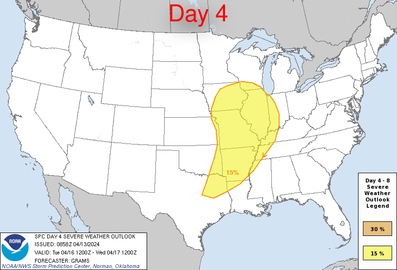
Day 4 Risk
Area (sq. mi.)
Area Pop.
Some Larger Population Centers in Risk Area
15 %
306,494
34,036,992
Chicago, IL...Memphis, TN...Kansas City, MO...St. Louis, MO...Madison, WI...
Day 5 Risk
Area (sq. mi.)
Area Pop.
Some Larger Population Centers in Risk Area
No Risk Areas Forecast
Day 6 Risk
Area (sq. mi.)
Area Pop.
Some Larger Population Centers in Risk Area
No Risk Areas Forecast
Day 7 Risk
Area (sq. mi.)
Area Pop.
Some Larger Population Centers in Risk Area
No Risk Areas Forecast
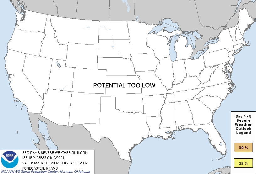
Day 8 Risk
Area (sq. mi.)
Area Pop.
Some Larger Population Centers in Risk Area
No Risk Areas Forecast
D4
Tue, Apr 16, 2024 - Wed, Apr 17, 2024
D7
Fri, Apr 19, 2024 - Sat, Apr 20, 2024
D5
Wed, Apr 17, 2024 - Thu, Apr 18, 2024
D8
Sat, Apr 20, 2024 - Sun, Apr 21, 2024
D6
Thu, Apr 18, 2024 - Fri, Apr 19, 2024
(All days are valid from 12 UTC - 12 UTC the following day)
Note: A severe weather area depicted in the Day 4-8 period indicates 15%, 30% or higher probability for severe thunderstorms within 25 miles of any point.
PREDICTABILITY TOO LOW is used to indicate severe storms may be possible based on some model scenarios. However, the location or occurrence of severe storms are in doubt due to: 1) large differences in the deterministic model solutions, 2) large spread in the ensemble guidance, and/or 3) minimal run-to-run continuity.
POTENTIAL TOO LOW means the threat for a regional area of organized severe storms appears unlikely (i.e., less than 15%) for the forecast day.
Forecast Discussion
   ZCZC SPCSWOD48 ALL
   ACUS48 KWNS 130858
   SPC AC 130858

   Day 4-8 Convective Outlook
   NWS Storm Prediction Center Norman OK
   0358 AM CDT Sat Apr 13 2024

   Valid 161200Z - 211200Z

   ...DISCUSSION...
   ...D4/Tuesday...
   A deep surface cyclone over the central Great Plains at 12Z Tuesday
   should gradually progress east-northeast to the Upper MS Valley by
   early Wednesday. An intense mid-level jetlet (in excess of 80 kts)
   from northwest TX into southern KS should move east across the Ozark
   Plateau before weakening Tuesday night as it reaches the Lower OH
   Valley. The initially north/south-oriented cold front to the south
   of the surface low will move farther east faster near the cyclone,
   but slow and stall farther south over the Ark-La-Tex.

   Synoptically, two favored regions for severe storms Tuesday
   afternoon/evening will be within the left-exit region of the intense
   mid-level jet in parts of IA/MO/IL, and over the Ark-La-Tex into the
   Mid-South where frontal convection will intersect with the richer
   low-level moisture plume emanating north from the western Gulf. A
   broad severe weather highlight remains warranted, with areas of
   higher probabilities likely being needed in later outlooks as
   mesoscale details become clearer given that the instability/buoyancy
   plume should be confined and modulated by late D3-early D4
   convection.

   ...D5/Wednesday...
   Latest guidance suggest some severe threat should persist into early
   D5 given the strength of low to mid-level flow before the deep
   surface cyclone occludes and dampens over the Great Lakes. The
   northeast lobe of the warm-moist sector emanating from the western
   Gulf should be further confined relative to D4. Conditionally, the
   central OH Valley vicinity appears to have the best opportunity to
   destabilize in the wake of late D4-early D5 convection and overlap
   with the stronger flow fields. This area will be monitored for a
   possible severe weather highlight in the next outlook cycle.

   ...D6/Thursday...
   With a broad upper trough becoming established over the Upper
   Midwest, a building surface anticyclone over the Great Plains should
   support a reinforcing cold front impinging on the rich western Gulf
   moisture plume over parts of TX into AR/LA. Some severe potential
   may evolve given increasingly larger CAPE compared to prior days,
   but overall shear profiles appear modest.

   ..Grams.. 04/13/2024

   CLICK TO GET WUUS48 PTSD48 PRODUCT


 @NWSSPC