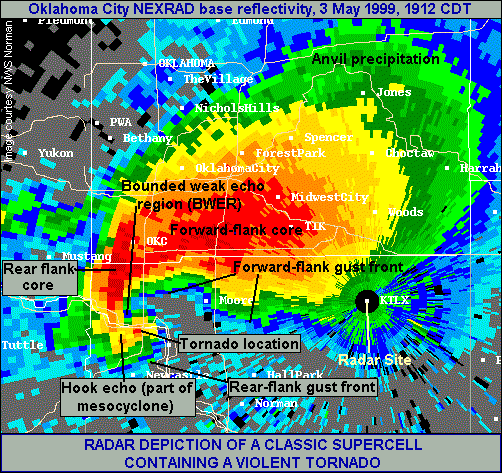
Radar Image of a Violent Tornadic Supercell
The "hook echo" in radar reflectivity imagery has been associated with tornado-producing thunderstorms since the 1950s. Rarely, however, is the signature this classical, this obvious. At the time of this image, a tornado was crossing Interstate 44 near the Canadian River, after producing F5 damage in Bridge Creek OK, and before more F5 damage in Moore. The bright red colors at the tornado location represent not rain or hail -- but the aggregate signature of car parts, pieces of houses, shredded tree branches, dirt and other debris, hoisted thousands of feet skyward by the tornado vortex!