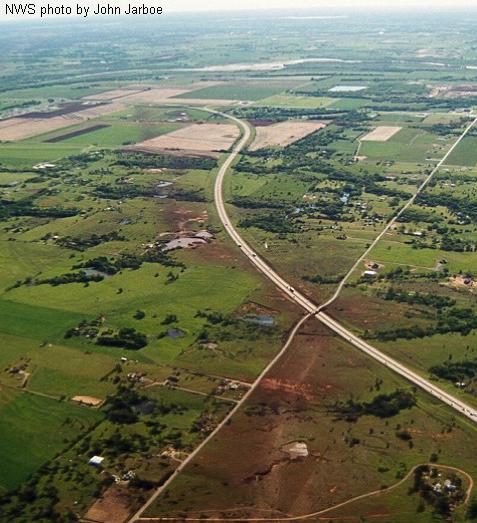
Aerial View of a Tornado Track
The reddish swath extending from the bottom toward the horizon at upper left is a relatively narrow part of the track of the Bridge Creek/Moore OK tornado from 3 May 1999. This view is northeastward down the path. Here, the tornado went through a sparsely developed area in the Canadian River valley, striking mainly vegetation, outbuildings, Interstate 44 (divided highway in the photo) and a few farms. Although it inflicted F5 damage elsewhere, the rating for this part of the path was only F2-F3, possibly because of a lack of substantially built structures with which to gauge tornado strength. Still, the tornado shredded all manner of trees, scouring away grass and brush to reveal the underlying red clay soil. One person was killed as the tornado passed across the bridge here, underscoring the danger of using overpasses as tornado shelters.