|
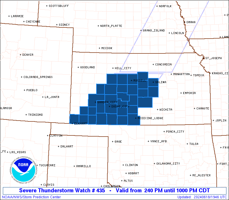
Initial List of Counties in SPC Severe Thunderstorm Watch 435 (WOU)
|
Back to Watch 435
|
 |
   WOUS64 KWNS 181939
   WOU5

   BULLETIN - IMMEDIATE BROADCAST REQUESTED
   SEVERE THUNDERSTORM WATCH OUTLINE UPDATE FOR WS 435
   NWS STORM PREDICTION CENTER NORMAN OK
   240 PM CDT TUE JUN 18 2024

   SEVERE THUNDERSTORM WATCH 435 IS IN EFFECT UNTIL 1000 PM CDT
   FOR THE FOLLOWING LOCATIONS

   KSC007-009-025-033-047-051-053-055-057-067-069-081-083-097-101-
   105-113-119-129-135-145-151-155-159-165-167-169-175-185-189-195-
   190300-
   /O.NEW.KWNS.SV.A.0435.240618T1940Z-240619T0300Z/

   KS
   .    KANSAS COUNTIES INCLUDED ARE

   BARBER               BARTON              CLARK
   COMANCHE             EDWARDS             ELLIS
   ELLSWORTH            FINNEY              FORD
   GRANT                GRAY                HASKELL
   HODGEMAN             KIOWA               LANE
   LINCOLN              MCPHERSON           MEADE
   MORTON               NESS                PAWNEE
   PRATT                RENO                RICE
   RUSH                 RUSSELL             SALINE
   SEWARD               STAFFORD            STEVENS
   TREGO


   ATTN...WFO...DDC...ICT...
|
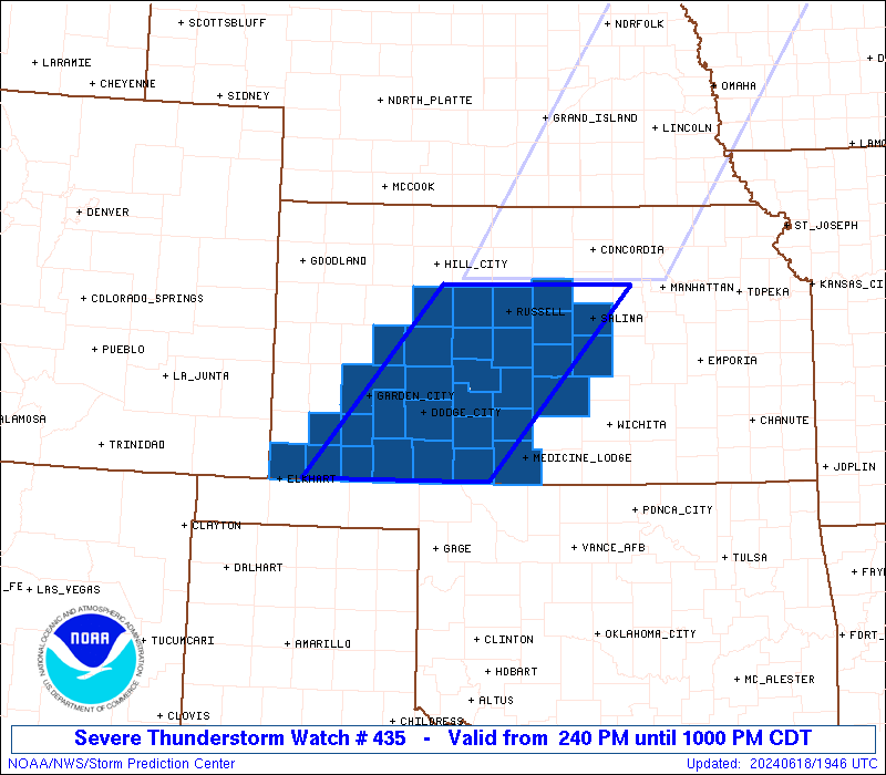
| Aviation Watch (SAW) for WW435 |
|---|
 |
| Note:
The Aviation Watch (SAW) product is an approximation to the watch area.
The actual watch is depicted by the shaded areas. |
   SAW5
   WW 435 SEVERE TSTM KS 181940Z - 190300Z
   AXIS..70 STATUTE MILES EAST AND WEST OF LINE..
   30NE RSL/RUSSELL KS/ - 35E LBL/LIBERAL KS/
   ..AVIATION COORDS.. 60NM E/W /40WNW SLN - 30E LBL/
   HAIL SURFACE AND ALOFT..2.5 INCHES. WIND GUSTS..70 KNOTS.
   MAX TOPS TO 600. MEAN STORM MOTION VECTOR 25030.

   LAT...LON 39169712 37039907 37030160 39169973

   THIS IS AN APPROXIMATION TO THE WATCH AREA.  FOR A
   COMPLETE DEPICTION OF THE WATCH SEE WOUS64 KWNS
   FOR WOU5.
|
|


 @NWSSPC