|
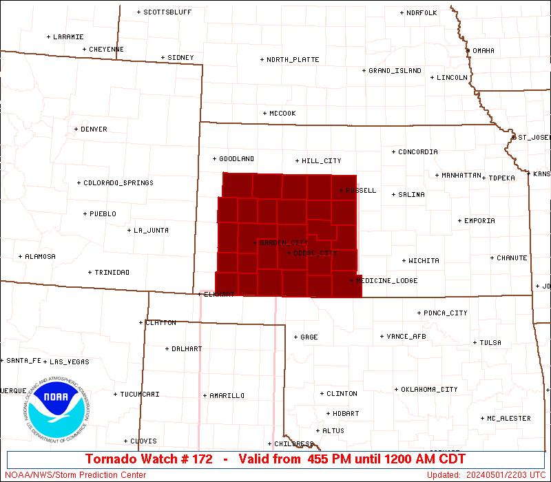
Initial List of Counties in SPC Tornado Watch 172 (WOU)
|
Back to Watch 172
|
 |
   WOUS64 KWNS 012156
   WOU2

   BULLETIN - IMMEDIATE BROADCAST REQUESTED
   TORNADO WATCH OUTLINE UPDATE FOR WT 172
   NWS STORM PREDICTION CENTER NORMAN OK
   455 PM CDT WED MAY 1 2024

   TORNADO WATCH 172 IS IN EFFECT UNTIL 1200 AM CDT FOR THE
    FOLLOWING LOCATIONS

   KSC007-009-025-033-047-051-055-057-063-067-069-081-083-093-097-
   101-109-119-135-145-151-165-167-171-175-185-189-195-203-
   020500-
   /O.NEW.KWNS.TO.A.0172.240501T2155Z-240502T0500Z/

   KS
   .    KANSAS COUNTIES INCLUDED ARE

   BARBER               BARTON              CLARK
   COMANCHE             EDWARDS             ELLIS
   FINNEY               FORD                GOVE
   GRANT                GRAY                HASKELL
   HODGEMAN             KEARNY              KIOWA
   LANE                 LOGAN               MEADE
   NESS                 PAWNEE              PRATT
   RUSH                 RUSSELL             SCOTT
   SEWARD               STAFFORD            STEVENS
   TREGO                WICHITA


   ATTN...WFO...DDC...GLD...ICT...
|
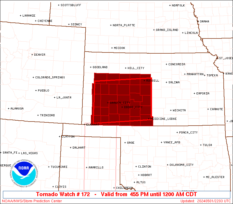
| Aviation Watch (SAW) for WW172 |
|---|
 |
| Note:
The Aviation Watch (SAW) product is an approximation to the watch area.
The actual watch is depicted by the shaded areas. |
   SAW2
   WW 172 TORNADO KS 012155Z - 020500Z
   AXIS..60 STATUTE MILES NORTH AND SOUTH OF LINE..
   40W GCK/GARDEN CITY KS/ - 55SSE RSL/RUSSELL KS/
   ..AVIATION COORDS.. 50NM N/S /34W GCK - 46WNW ICT/
   HAIL SURFACE AND ALOFT..3.5 INCHES. WIND GUSTS..60 KNOTS.
   MAX TOPS TO 500. MEAN STORM MOTION VECTOR 24025.

   LAT...LON 38800145 38999843 37259843 37060145

   THIS IS AN APPROXIMATION TO THE WATCH AREA.  FOR A
   COMPLETE DEPICTION OF THE WATCH SEE WOUS64 KWNS
   FOR WOU2.
|
|


 @NWSSPC