|
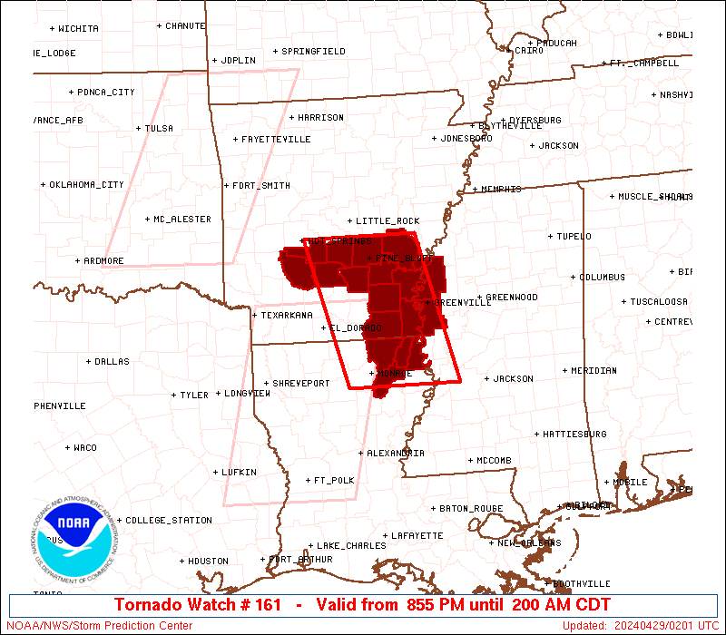
Initial List of Counties in SPC Tornado Watch 161 (WOU)
|
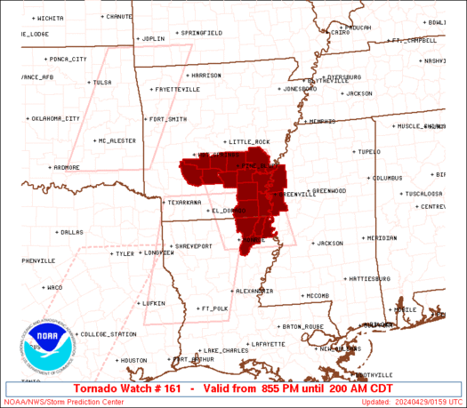
Back to Watch 161
|
 |
   WOUS64 KWNS 290151
   WOU1

   BULLETIN - IMMEDIATE BROADCAST REQUESTED
   TORNADO WATCH OUTLINE UPDATE FOR WT 161
   NWS STORM PREDICTION CENTER NORMAN OK
   855 PM CDT SUN APR 28 2024

   TORNADO WATCH 161 IS IN EFFECT UNTIL 200 AM CDT FOR THE
    FOLLOWING LOCATIONS

   ARC001-003-017-019-025-039-041-043-053-059-069-079-290700-
   /O.NEW.KWNS.TO.A.0161.240429T0155Z-240429T0700Z/

   AR
   .    ARKANSAS COUNTIES INCLUDED ARE

   ARKANSAS             ASHLEY              CHICOT
   CLARK                CLEVELAND           DALLAS
   DESHA                DREW                GRANT
   HOT SPRING           JEFFERSON           LINCOLN


   LAC035-067-083-123-290700-
   /O.NEW.KWNS.TO.A.0161.240429T0155Z-240429T0700Z/

   LA
   .    LOUISIANA PARISHES INCLUDED ARE

   EAST CARROLL         MOREHOUSE           RICHLAND
   WEST CARROLL


   MSC011-151-290700-
   /O.NEW.KWNS.TO.A.0161.240429T0155Z-240429T0700Z/

   MS
   .    MISSISSIPPI COUNTIES INCLUDED ARE

   BOLIVAR              WASHINGTON


   ATTN...WFO...LZK...JAN...
|
| Aviation Watch (SAW) for WW161 |
|---|
 |
| Note:
The Aviation Watch (SAW) product is an approximation to the watch area.
The actual watch is depicted by the shaded areas. |
   SAW1
   WW 161 TORNADO AR LA MS 290155Z - 290700Z
   AXIS..55 STATUTE MILES EAST AND WEST OF LINE..
   25NNW PBF/PINE BLUFF AR/ - 35ESE MLU/MONROE LA/
   ..AVIATION COORDS.. 50NM E/W /11SSE LIT - 30ESE MLU/
   HAIL SURFACE AND ALOFT..1 INCH. WIND GUSTS..60 KNOTS.
   MAX TOPS TO 400. MEAN STORM MOTION VECTOR 24035.

   LAT...LON 34509113 32329053 32329242 34509306

   THIS IS AN APPROXIMATION TO THE WATCH AREA.  FOR A
   COMPLETE DEPICTION OF THE WATCH SEE WOUS64 KWNS
   FOR WOU1.
|
|


 @NWSSPC