|
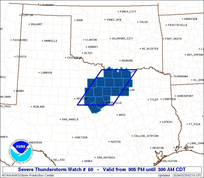
Initial List of Counties in SPC Severe Thunderstorm Watch 60 (WOU)
|
Back to Watch 60
|
 |
   WOUS64 KWNS 250202
   WOU0

   BULLETIN - IMMEDIATE BROADCAST REQUESTED
   SEVERE THUNDERSTORM WATCH OUTLINE UPDATE FOR WS 60
   NWS STORM PREDICTION CENTER NORMAN OK
   905 PM CDT SUN MAR 24 2024

   SEVERE THUNDERSTORM WATCH 60 IS IN EFFECT UNTIL 300 AM CDT
   FOR THE FOLLOWING LOCATIONS

   TXC085-093-097-113-121-133-143-181-221-237-337-363-367-425-429-
   439-497-503-250800-
   /O.NEW.KWNS.SV.A.0060.240325T0205Z-240325T0800Z/

   TX
   .    TEXAS COUNTIES INCLUDED ARE

   COLLIN               COMANCHE            COOKE
   DALLAS               DENTON              EASTLAND
   ERATH                GRAYSON             HOOD
   JACK                 MONTAGUE            PALO PINTO
   PARKER               SOMERVELL           STEPHENS
   TARRANT              WISE                YOUNG


   ATTN...WFO...FWD...
|
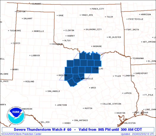
| Aviation Watch (SAW) for WW60 |
|---|
 |
| Note:
The Aviation Watch (SAW) product is an approximation to the watch area.
The actual watch is depicted by the shaded areas. |
   SAW0
   WW 60 SEVERE TSTM TX 250205Z - 250800Z
   AXIS..60 STATUTE MILES EAST AND WEST OF LINE..
   25WNW GYI/SHERMAN TX/ - 20WSW SEP/STEPHENVILLE TX/
   ..AVIATION COORDS.. 50NM E/W /22SSE ADM - 68WNW ACT/
   HAIL SURFACE AND ALOFT..2 INCHES. WIND GUSTS..55 KNOTS.
   MAX TOPS TO 450. MEAN STORM MOTION VECTOR 25025.

   LAT...LON 33849603 32099747 32099952 33849812

   THIS IS AN APPROXIMATION TO THE WATCH AREA.  FOR A
   COMPLETE DEPICTION OF THE WATCH SEE WOUS64 KWNS
   FOR WOU0.
|
|


 @NWSSPC