|
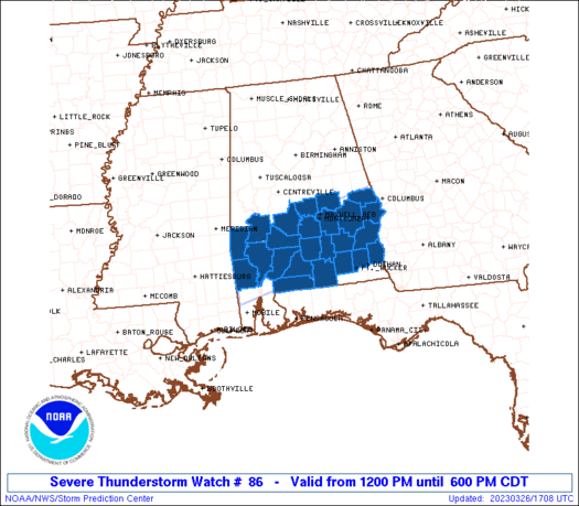
Initial List of Counties in SPC Severe Thunderstorm Watch 86 (WOU)
|
Back to Watch 86
|
 |
   WOUS64 KWNS 261700
   WOU6

   BULLETIN - IMMEDIATE BROADCAST REQUESTED
   SEVERE THUNDERSTORM WATCH OUTLINE UPDATE FOR WS 86
   NWS STORM PREDICTION CENTER NORMAN OK
   1200 PM CDT SUN MAR 26 2023

   SEVERE THUNDERSTORM WATCH 86 IS IN EFFECT UNTIL 600 PM CDT
   FOR THE FOLLOWING LOCATIONS

   ALC001-005-011-013-023-025-031-035-039-041-045-047-051-053-067-
   081-085-087-091-099-101-109-113-129-131-262300-
   /O.NEW.KWNS.SV.A.0086.230326T1700Z-230326T2300Z/

   AL
   .    ALABAMA COUNTIES INCLUDED ARE

   AUTAUGA              BARBOUR             BULLOCK
   BUTLER               CHOCTAW             CLARKE
   COFFEE               CONECUH             COVINGTON
   CRENSHAW             DALE                DALLAS
   ELMORE               ESCAMBIA            HENRY
   LEE                  LOWNDES             MACON
   MARENGO              MONROE              MONTGOMERY
   PIKE                 RUSSELL             WASHINGTON
   WILCOX


   ATTN...WFO...BMX...MOB...TAE...
|
| Aviation Watch (SAW) for WW86 |
|---|
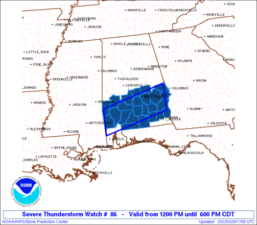 |
| Note:
The Aviation Watch (SAW) product is an approximation to the watch area.
The actual watch is depicted by the shaded areas. |
   SAW6
   WW 86 SEVERE TSTM AL 261700Z - 262300Z
   AXIS..40 STATUTE MILES NORTH AND SOUTH OF LINE..
   80W GZH/EVERGREEN AL/ - 30SSE AUO/AUBURN AL/
   ..AVIATION COORDS.. 35NM N/S /41N SJI - 51S LGC/
   HAIL SURFACE AND ALOFT..1.5 INCHES. WIND GUSTS..55 KNOTS.
   MAX TOPS TO 500. MEAN STORM MOTION VECTOR 25025.

   LAT...LON 31998840 32798523 31638523 30838840

   THIS IS AN APPROXIMATION TO THE WATCH AREA.  FOR A
   COMPLETE DEPICTION OF THE WATCH SEE WOUS64 KWNS
   FOR WOU6.
|
|


 @NWSSPC
