|
| Mesoscale Discussion 1536 |
|
< Previous MD Next MD >
|
|
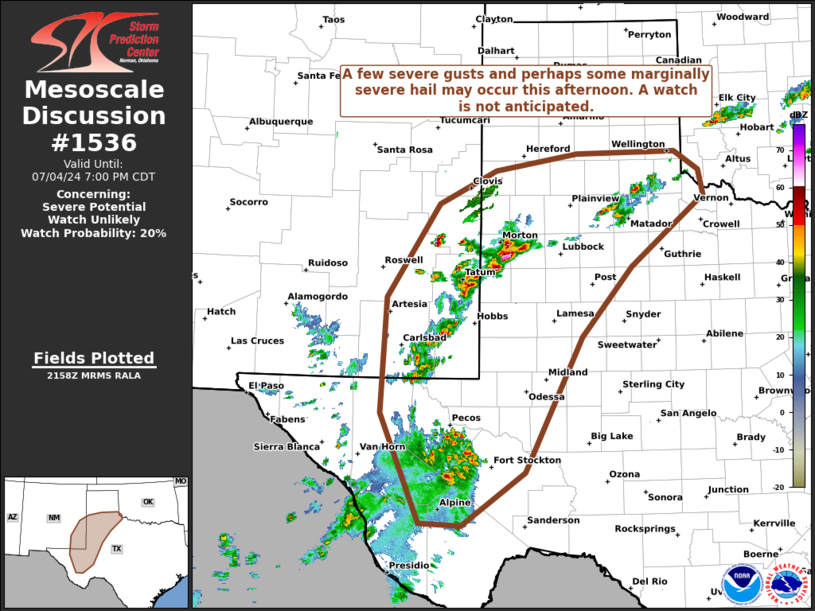
   Mesoscale Discussion 1536
   NWS Storm Prediction Center Norman OK
   0501 PM CDT Thu Jul 04 2024

   Areas affected...Portions of western Texas and southeastern New
   Mexico

   Concerning...Severe potential...Watch unlikely

   Valid 042201Z - 050000Z

   Probability of Watch Issuance...20 percent

   SUMMARY...Severe storms with a few severe gusts and perhaps some
   marginally severe hail are possible this afternoon across portions
   of west Texas and southeast New Mexico. A watch is not anticipated.

   DISCUSSION...Storms are ongoing this afternoon near the Texas/New
   Mexico border and across the southern Texas Panhandle in an
   environment characterized by large dewpoint depressions and
   inverted-V thermodynamic profiles per surface observations and
   short-term RAP forecasts. These storms are also situated well south
   of the best deep layer shear in an environment with 20 kts or less
   of effective bulk shear. Due to the large evaporative cooling
   potential with the inverted-V thermodynamic profiles and steep
   low-level lapse rates, some downburst activity is possible, and this
   may result in a few severe gusts. Additionally, with the deep CAPE
   profile, most of which is above the freezing level, some marginally
   severe hail is possible with some of the stronger storms. With time,
   storms expected to continue moving slowly to the east with
   short-term guidance dissipating most convection near sunset.
   Additionally, some storm clustering and merging of cold pools may
   occur, and this may also result in a risk for severe gusts.

   ..Supinie/Hart.. 07/04/2024

   ...Please see www.spc.noaa.gov for graphic product...

   ATTN...WFO...OUN...SJT...LUB...AMA...MAF...ABQ...

   LAT...LON   33020444 34200365 34620281 34820159 34850011 34609975
               34289968 33400077 32520152 30810237 30140331 30180393
               31550452 33020444
|
|
Top/All Mesoscale Discussions/Forecast Products/Home
|
|


 @NWSSPC