|
| Mesoscale Discussion 667 |
|
< Previous MD Next MD >
|
|
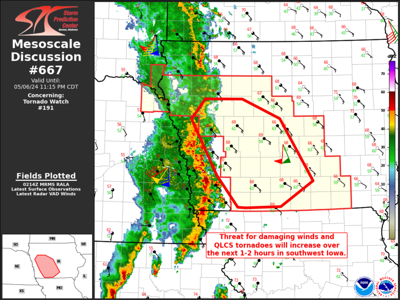
   Mesoscale Discussion 0667
   NWS Storm Prediction Center Norman OK
   0916 PM CDT Mon May 06 2024

   Areas affected...Southwest into parts of central Iowa

   Concerning...Tornado Watch 191...

   Valid 070216Z - 070415Z

   The severe weather threat for Tornado Watch 191 continues.

   SUMMARY...An increase in damaging wind and QLCS tornado threat can
   be expected in southwest Iowa over the next 1-2 hours. Some risk
   will continue into central Iowa later this evening.

   DISCUSSION...Numerous wind damage reports as well as several
   observed/estimated severe gusts have occurred in
   southeast/east-central Nebraska. Moisture advection continues to
   maintain low 60s F dewpoints into southwest Iowa. Thought buoyancy
   will be limited to some extent, convection should remain
   surface-based for another few hours with additional support from the
   shortwave pivoting through the mid-Missouri Valley. The KDMX VAD
   shows 0-1 km SRH of over 400 m2/s2. Several QLCS
   circulations/tornadoes are possible along with a continued damaging
   wind threat. Given the forcing from the low-level jet and the
   upper-level shortwave, this activity seems likely to at least reach
   parts of central Iowa. Beyond 06Z, the low-level jet is forecast to
   weaken which could begin to limit the intensity of the line.

   ..Wendt.. 05/07/2024

   ...Please see www.spc.noaa.gov for graphic product...

   ATTN...WFO...DMX...FSD...OAX...

   LAT...LON   40649475 41199523 42169584 42519552 42519465 42169379
               41089303 40649377 40639457 40649475
|
|
Top/All Mesoscale Discussions/Forecast Products/Home
|
|


 @NWSSPC