|
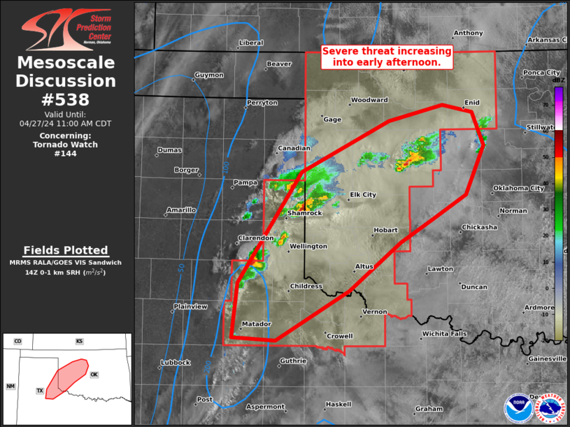
| Mesoscale Discussion 538 |
|
< Previous MD Next MD >
|

|
   Mesoscale Discussion 0538
   NWS Storm Prediction Center Norman OK
   0210 AM CDT Thu Apr 24 2025

   Areas affected...North Texas...Southern Oklahoma

   Concerning...Severe Thunderstorm Watch 165...

   Valid 240710Z - 240915Z

   The severe weather threat for Severe Thunderstorm Watch 165
   continues.

   SUMMARY...An isolated potential for severe wind gusts is expected to
   continue over parts of southern Oklahoma and north Texas late
   tonight into the early morning. The threat should become marginal,
   and weather watch issuance appears unlikely to the east of WW 165.

   DISCUSSION...The latest hi-resolution radar imagery from Frederick,
   Oklahoma shows a line of strong thunderstorms from southwest
   Oklahoma into northwest Texas. This line is located near the
   northwestern edge of a moist airmass, along a north-to-south axis of
   moderate instability. Ahead of the path of the convective line, the
   RAP is estimating MLCAPE from 500 to 1500 J/kg. In addition, water
   vapor imagery and RAP analysis suggest that a low-amplitude
   shortwave trough is moving through the southern and central Plains.
   Large-scale ascent, along with the instability and low-level warm
   advection, is supporting the convective line. The DYX WSR-88D VWP
   has some directional shear in the lowest 3 kilometers and has 0-6 km
   shear in the 30 to 35 knot range. This should be enough to continue
   an isolated wind-damage threat along and ahead of the stronger parts
   of the line over the next couple of hours. However, the line will
   move eastward into weak instability, which will likely marginalize
   the severe threat.

   ..Broyles.. 04/24/2025

   ...Please see www.spc.noaa.gov for graphic product...

   ATTN...WFO...FWD...OUN...SJT...

   LAT...LON   32969768 33049906 33299959 33599964 34279914 34989885
               35059802 34499631 34009601 33459607 33029644 32969768

   MOST PROBABLE PEAK WIND GUST...55-70 MPH
   MOST PROBABLE PEAK HAIL SIZE...UP TO 1.25 IN
|
|
Top/All Mesoscale Discussions/Forecast Products/Home
|
|


