|
| Mesoscale Discussion 1464 |
|
< Previous MD Next MD >
|
|
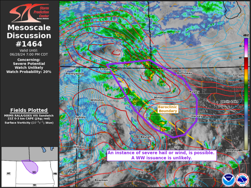
   Mesoscale Discussion 1464
   NWS Storm Prediction Center Norman OK
   0524 PM CDT Fri Jun 28 2024

   Areas affected...portions of northern North Dakota

   Concerning...Severe potential...Watch unlikely

   Valid 282224Z - 290000Z

   Probability of Watch Issuance...20 percent

   SUMMARY...Isolated severe hail/wind are possible this afternoon.
   Given the isolated nature of the severe threat, a WW issuance is not
   currently expected.

   DISCUSSION...Thunderstorms are intensifying along a pronounced
   baroclinic boundary that resides immediately ahead of an approaching
   500 mb vort max along the ND/MT border region. Along this boundary,
   8 C/km 0-3 km lapse rates are present, boosting the 0-3 km CAPE to
   over 150 J/kg in spots (per 22Z mesoanalysis). Given modest
   deep-layer shear, shorter-lived multicells capable of isolated
   instances of severe hail and wind are expected. If more dominant,
   cellular convection can anchor to the boundary for any appreciable
   period of time, a landspout tornado cannot be ruled out.
   Nonetheless, given how sparse and marginal the severe threat is
   expected to be, a WW issuance is not currently anticipated.

   ..Squitieri/Smith.. 06/28/2024

   ...Please see www.spc.noaa.gov for graphic product...

   ATTN...WFO...FGF...BIS...

   LAT...LON   49080303 49200144 48740018 48239969 47709973 47360017
               47300058 47510127 47960196 49080303
|
|
Top/All Mesoscale Discussions/Forecast Products/Home
|
|


 @NWSSPC