|
| Mesoscale Discussion 868 |
|
< Previous MD Next MD >
|
|
Mesoscale Discussion 0868
NWS Storm Prediction Center Norman OK
0929 AM CDT Tue May 21 2024
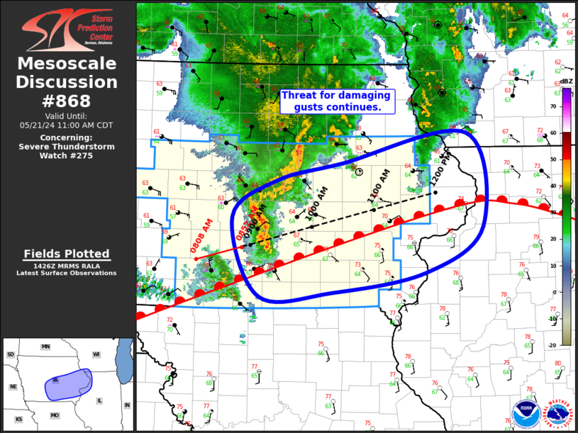
Areas affected...Central/Eastern IA...Far Southwest WI...Far
Northwest IL
Concerning...Severe Thunderstorm Watch 275...
Valid 211429Z - 211600Z
The severe weather threat for Severe Thunderstorm Watch 275
continues.
SUMMARY...Threat for damaging gusts will continue across central and
eastern IA for the next few hours.
DISCUSSION...A convective line continues over central IA, with
recent storm motion estimated to be northeastward at 40-45 kt. This
motion takes the line into more of eastern IA between 15Z and 16Z.
Recent surface analysis places a warm front from far southwest IA
northeastward to south of CID and then eastward into northern IL.
The ongoing convective line is currently north of this boundary,
with the elevated character to this line likely contributing to the
lack of measured surface gusts. The southwest-to-northeast
orientation of the warm front and its somewhat slow motion north
coupled with the predominantly northeastward motion of the line
casts some doubt to whether or not this line will be able to evolve
towards a more surface-based character with eastern extent. If it
does, some trend towards stronger and more frequent gusts is
possible. Even if the line remains elevated, the overall environment
is expected to improve as it moves downstream, with damaging gusts
remaining possible.
Additionally, given the improving environmental conditions
anticipated, overall convective trends will be monitored for
potential downstream watch issuance into northwest IL and southwest
WI.
..Mosier.. 05/21/2024
...Please see www.spc.noaa.gov for graphic product...
ATTN...WFO...MKX...DVN...ARX...DMX...
LAT...LON 41669404 42109334 42329230 42679031 41559005 41009096
40769245 40729362 41669404
|
|
Top/All Mesoscale Discussions/Forecast Products/Home
|
|


 @NWSSPC