|
| Mesoscale Discussion 638 |
|
< Previous MD Next MD >
|
|
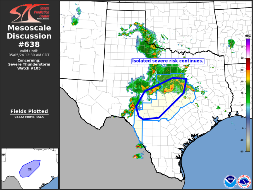
   Mesoscale Discussion 0638
   NWS Storm Prediction Center Norman OK
   1025 PM CDT Sat May 04 2024

   Areas affected...portions of central Texas

   Concerning...Severe Thunderstorm Watch 185...

   Valid 050325Z - 050530Z

   The severe weather threat for Severe Thunderstorm Watch 185
   continues.

   SUMMARY...Widespread convection continues across portions of central
   Texas, along with isolated severe risk.

   DISCUSSION...Latest radar loop shows a large area of storm moving
   across central texas, with more isolated storms extending
   southwestward across the Edwards Plateau area.  While overall severe
   risk has gradually decreased, stronger/organized updrafts persist
   locally, which will likely remain the case over the next few hours.
   The most substantial storm remains the long-lived/rotating cluster
   now crossing the western Sutton County vicinity, where damaging
   winds and hail appear likely, along with some chance for a brief
   tornado.

   ..Goss.. 05/05/2024

   ...Please see www.spc.noaa.gov for graphic product...

   ATTN...WFO...FWD...EWX...SJT...

   LAT...LON   29670007 29870037 30450058 31439996 32289791 32219690
               31329713 29799893 29670007
|
|
Top/All Mesoscale Discussions/Forecast Products/Home
|
|


 @NWSSPC