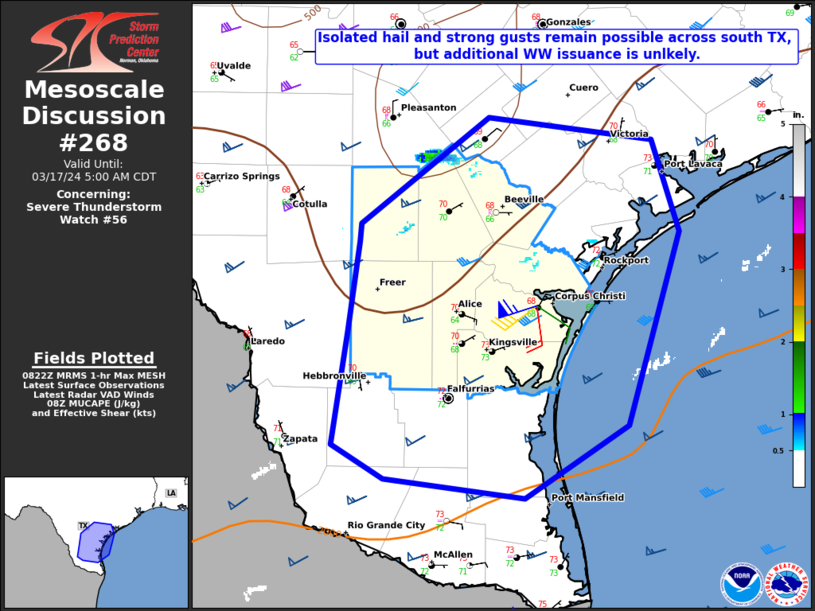
   Mesoscale Discussion 0268
   NWS Storm Prediction Center Norman OK
   0324 AM CDT Sun Mar 17 2024

   Areas affected...Parts of south TX

   Concerning...Severe Thunderstorm Watch 56...

   Valid 170824Z - 171000Z

   The severe weather threat for Severe Thunderstorm Watch 56
   continues.

   SUMMARY...Some threat for localized hail and strong gusts remains
   possible across parts of south TX, but the threat appears too
   isolated for additional watch issuance.

   DISCUSSION...Convection has struggled to remain organized across
   parts of south TX early this morning, though occasional upticks in
   intensity have been noted with individual cells, accompanied by
   increased hail potential (as noted in MRMS MESH data). While MUCAPE
   is generally in the 1000-2000 J/kg range across the region, some
   MUCINH remains due to warm temperatures in the 800-700 mb layer.
   Much of the convection is likely rooted near/above this layer, with
   less available buoyancy, though isolated hail cannot be ruled out
   with the strongest updrafts.

   If any cells can become rooted closer to the surface, then available
   buoyancy and effective shear would both increase, with some
   supercell potential. However, this scenario remains highly
   conditional, with large-scale ascent expected to weaken as a
   convectively enhanced midlevel shortwave trough begins to move away
   from the region. Unless an uptick in storm organization is observed,
   additional watch issuance is not expected.

   ..Dean/Thompson.. 03/17/2024

   ...Please see www.spc.noaa.gov for graphic product...

   ATTN...WFO...HGX...CRP...EWX...BRO...

   LAT...LON   28299873 28949784 28819669 28239650 27049686 26589759
               26709857 26929893 27629881 28189874 28299873
|


 @NWSSPC