|
| Mesoscale Discussion 1123 |
|
< Previous MD Next MD >
|
|
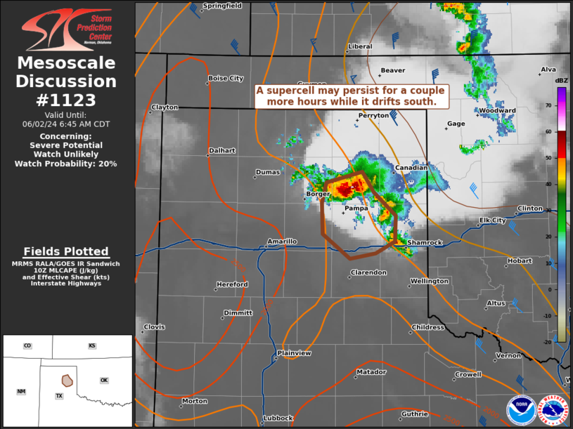
   Mesoscale Discussion 1123
   NWS Storm Prediction Center Norman OK
   0546 AM CDT Sun Jun 02 2024

   Areas affected...the Eastern TX Panhandle

   Concerning...Severe potential...Watch unlikely

   Valid 021046Z - 021145Z

   Probability of Watch Issuance...20 percent

   SUMMARY...A supercell over the eastern Texas Panhandle may persist
   for a couple more hours as it drifts southward. A confined swath of
   large hail and severe wind gusts will be possible. The limited
   spatial extent and uncertainty over longevity should preclude a WW
   issuance.

   DISCUSSION...Along the trailing outflow from a decayed MCS and
   remnant MCV over north-central OK, a supercell formed last hour in
   the northeast TX Panhandle. This storm has been rather slow-moving,
   drifting southward near 10 kts across Roberts County. Occasionally,
   this storm has had echo tops over 50k ft, along with MRMS MESH
   around 2 inches. In addition, robust inbound velocities have also
   been noted on the west to north side of the deep mesocyclone. With
   the Amarillo VWP showing relatively stable 30-35 kt low-level
   southerlies, it is plausible that this supercell may persist for at
   least a couple more hours as it gradually drifts towards the I-40
   corridor.

   ..Grams/Thompson.. 06/02/2024

   ...Please see www.spc.noaa.gov for graphic product...

   ATTN...WFO...AMA...

   LAT...LON   35910074 35730060 35500036 35270037 35160059 35100088
               35330118 35630120 35820115 35910074
|
|
Top/All Mesoscale Discussions/Forecast Products/Home
|
|


 @NWSSPC