Day 4-8 Severe Weather Outlook Issued on May 1, 2024
Updated: Wed May 1 09:05:03 UTC 2024
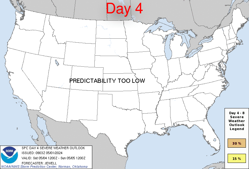
Day 4 Risk
Area (sq. mi.)
Area Pop.
Some Larger Population Centers in Risk Area
No Risk Areas Forecast
Day 5 Risk
Area (sq. mi.)
Area Pop.
Some Larger Population Centers in Risk Area
No Risk Areas Forecast
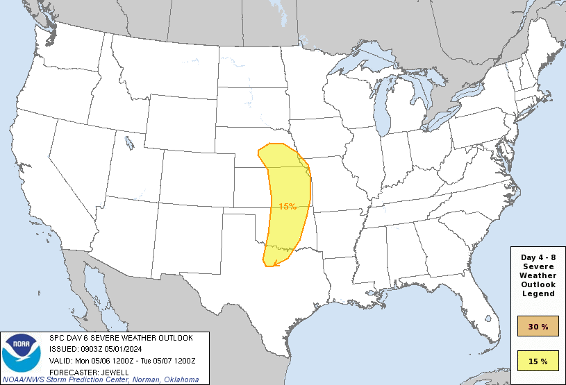
Day 6 Risk
Area (sq. mi.)
Area Pop.
Some Larger Population Centers in Risk Area
15 %
113,671
6,893,017
Oklahoma City, OK...Tulsa, OK...Wichita, KS...Lincoln, NE...Topeka, KS...
Day 7 Risk
Area (sq. mi.)
Area Pop.
Some Larger Population Centers in Risk Area
No Risk Areas Forecast
Day 8 Risk
Area (sq. mi.)
Area Pop.
Some Larger Population Centers in Risk Area
No Risk Areas Forecast
D4
Sat, May 04, 2024 - Sun, May 05, 2024
D7
Tue, May 07, 2024 - Wed, May 08, 2024
D5
Sun, May 05, 2024 - Mon, May 06, 2024
D8
Wed, May 08, 2024 - Thu, May 09, 2024
D6
Mon, May 06, 2024 - Tue, May 07, 2024
(All days are valid from 12 UTC - 12 UTC the following day)
Note: A severe weather area depicted in the Day 4-8 period indicates 15%, 30% or higher probability for severe thunderstorms within 25 miles of any point.
PREDICTABILITY TOO LOW is used to indicate severe storms may be possible based on some model scenarios. However, the location or occurrence of severe storms are in doubt due to: 1) large differences in the deterministic model solutions, 2) large spread in the ensemble guidance, and/or 3) minimal run-to-run continuity.
POTENTIAL TOO LOW means the threat for a regional area of organized severe storms appears unlikely (i.e., less than 15%) for the forecast day.
Forecast Discussion
   ZCZC SPCSWOD48 ALL
   ACUS48 KWNS 010903
   SPC AC 010903

   Day 4-8 Convective Outlook
   NWS Storm Prediction Center Norman OK
   0403 AM CDT Wed May 01 2024

   Valid 041200Z - 091200Z

   ...DISCUSSION...
   For Saturday/D4 to Sunday/D5, scattered to perhaps numerous
   thunderstorms are possible over a large section of the CONUS from
   the southern Plains into the Southeast. Mid 60s F to lower 70s F
   dewpoints will be common across the entire area, aided by southerly
   surface winds around an East Coast high. Aloft, generally weak flow
   will exist over the same areas, well east of a developing western
   upper trough. As such, the weak shear will likely minimize overall
   severe potential through Sunday/D5.

   For Monday/D6, models have shown increased run-to-run consistency in
   depicting a deep upper trough developing over the Great Basin and
   emerging into the Plains. Rich low-level moisture will be in place
   ahead of this system, which is forecast to enter the central Plains
   with a negative tilt and strong shear. While minor trough-geometry
   differences exist amongst the models, the combination of
   strengthening shear, a potentially deep surface low and ample
   moisture and instability necessitate introducing severe
   probabilities for parts of the Plains on Monday. All facets of
   severe appear possible with such a system, including supercells,
   squall lines, tornadoes, damaging winds and large hail.

   ..Jewell.. 05/01/2024

   CLICK TO GET WUUS48 PTSD48 PRODUCT


 @NWSSPC