Day 4-8 Severe Weather Outlook Issued on Oct 29, 2022
Updated: Sat Oct 29 08:58:02 UTC 2022
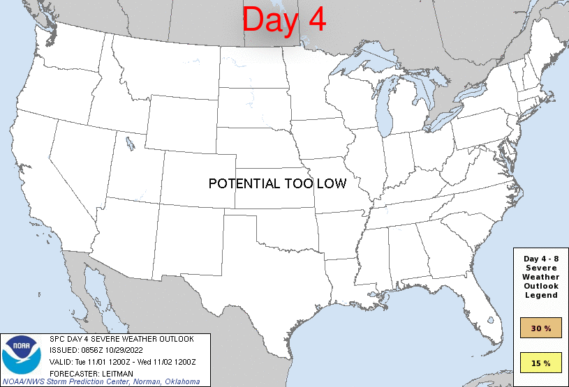
Day 4 Risk
Area (sq. mi.)
Area Pop.
Some Larger Population Centers in Risk Area
No Risk Areas Forecast
Day 5 Risk
Area (sq. mi.)
Area Pop.
Some Larger Population Centers in Risk Area
No Risk Areas Forecast
Day 6 Risk
Area (sq. mi.)
Area Pop.
Some Larger Population Centers in Risk Area
No Risk Areas Forecast
Day 7 Risk
Area (sq. mi.)
Area Pop.
Some Larger Population Centers in Risk Area
15 %
105,739
3,059,176
Oklahoma City, OK...Lubbock, TX...Abilene, TX...Norman, OK...Wichita Falls, TX...
Day 8 Risk
Area (sq. mi.)
Area Pop.
Some Larger Population Centers in Risk Area
No Risk Areas Forecast
D4
Tue, Nov 01, 2022 - Wed, Nov 02, 2022
D7
Fri, Nov 04, 2022 - Sat, Nov 05, 2022
D5
Wed, Nov 02, 2022 - Thu, Nov 03, 2022
D8
Sat, Nov 05, 2022 - Sun, Nov 06, 2022
D6
Thu, Nov 03, 2022 - Fri, Nov 04, 2022
(All days are valid from 12 UTC - 12 UTC the following day)
Note: A severe weather area depicted in the Day 4-8 period indicates 15%, 30% or higher probability for severe thunderstorms within 25 miles of any point.
PREDICTABILITY TOO LOW is used to indicate severe storms may be possible based on some model scenarios. However, the location or occurrence of severe storms are in doubt due to: 1) large differences in the deterministic model solutions, 2) large spread in the ensemble guidance, and/or 3) minimal run-to-run continuity.
POTENTIAL TOO LOW means the threat for a regional area of organized severe storms appears unlikely (i.e., less than 15%) for the forecast day.
Forecast Discussion
   ZCZC SPCSWOD48 ALL
   ACUS48 KWNS 290856
   SPC AC 290856

   Day 4-8 Convective Outlook
   NWS Storm Prediction Center Norman OK
   0356 AM CDT Sat Oct 29 2022

   Valid 011200Z - 061200Z

   ...DISCUSSION...
   ...Days 4-5/Tue-Wed -- Gulf Coast States...
   Severe potential appears low on Days 4-5/Tue-Wed. An upper shortwave
   trough will shift east/northeast from Texas to the Mid-South on Day
   4/Tue, and then offshore the Mid-Atlantic coast on Wednesday. While
   moderate southwesterly deep layer flow will overspread portions of
   the Lower MS Valley and Southeast, higher-quality boundary-layer
   moisture and a more unstable airmass will remain offshore over the
   Gulf, precluding severe potential.

   ...Days 6-8/Thu-Sat -- Southern Plains to Upper Midwest...
   By Day 6/Thu, a potent large-scale upper trough over the West will
   begin to migrate eastward, extending from the northern High Plains
   to northwest Mexico by Day 7/Fri morning. An upper low is forecast
   by most guidance to become increasingly cut-off from northern stream
   flow on Day 7-8/Fri-Sat as the system moves into the southern
   Plains. As this occurs, broad troughing will stretch across the
   northern tier of the U.S. near the international board, resulting in
   strong westerly flow across the Upper Midwest/Great Lakes, while
   intense southwesterly flow associated with the southern stream
   trough spreads east across the Plains.

   As surface low pressure develops over the central/southern High
   Plains with the approach of the western trough, southerly low-level
   flow will transport Gulf moisture northward into TX/OK/KS beginning
   Thursday. The northward extent of moisture return is uncertain, but
   some modest boundary-layer moisture could encroach on the Lower MO
   to Mid/Upper MS Valleys by Day 7-8/Fri-Sat as a strong cold front
   begins to shift east/southeast across the Plains and Upper Midwest.

   Severe potential may increase Thursday evening/overnight across
   portions of the southern Plains, though timing of moisture return
   makes this a bit uncertain. Severe potential appears more likely on
   Friday as higher-quality Gulf moisture will be in place ahead of the
   cold front across the southern Plains. A 15 percent severe area has
   been included for Friday given adequate moisture/instability
   aligning with strong vertical shear and an intense ejecting upper
   trough. This area may shift some in the coming days depending on
   forecast guidance trends, but confidence is high enough to introduce
   probabilities at this time, given multi-model consistency between
   deterministic, ensemble and machine learning guidance.

   ..Leitman.. 10/29/2022

   CLICK TO GET WUUS48 PTSD48 PRODUCT


 @NWSSPC