(All days are valid from 12 UTC - 12 UTC the following day)
Note: A severe weather area depicted in the Day 4-8 period indicates 15%, 30% or higher probability for severe thunderstorms within 25 miles of any point.
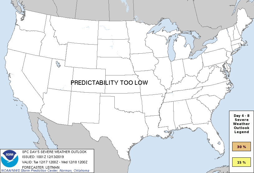
PREDICTABILITY TOO LOW is used to indicate severe storms may be possible based on some model scenarios. However, the location or occurrence of severe storms are in doubt due to: 1) large differences in the deterministic model solutions, 2) large spread in the ensemble guidance, and/or 3) minimal run-to-run continuity.
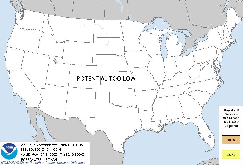
POTENTIAL TOO LOW means the threat for a regional area of organized severe storms appears unlikely (i.e., less than 15%) for the forecast day.
Forecast Discussion
ZCZC SPCSWOD48 ALL
ACUS48 KWNS 131001
SPC AC 131001
Day 4-8 Convective Outlook
NWS Storm Prediction Center Norman OK
0401 AM CST Fri Dec 13 2019
Valid 161200Z - 211200Z
...DISCUSSION...
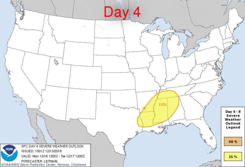
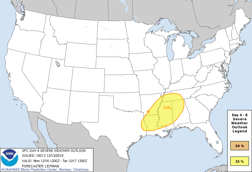
...Day 4/Monday - Lower MS and TN Valley Vicinity...
A positively tilted shortwave mid/upper trough will eject from the
Plains northeastward through the Ohio Valley on Monday, bringing a
band of strong deep-layer southwesterly flow across much of the
south-central and Midwestern states. At the surface, low pressure
over Arkansas will track northeast along the Ohio River toward
western PA by Tuesday morning. Strong south/southwesterly low-level
flow will bring Gulf moisture north and east across much of the
southern U.S., with 60s dewpoints reaching as far north northern AL
and perhaps middle TN. Forecast soundings indicate shear supportive
of rotating updrafts and supercell structures. However, deep-layer
flow will mostly parallel to an eastward-advancing cold front,
likely leading to messy storm mode. Nevertheless, MUCAPE of around
500-1500 J/kg is expected across the warm sector and a southwesterly
low level jet greater than 40 kt is forecast by most guidance. This
should be sufficient for isolated to widely scattered severe cells
and line segments capable of damaging gusts, a few tornadoes and
possibly hail (where cells can remain discrete). Some uncertainty in
north and east extent of the severe threat remains, and some changes
are likely in coming outlook updates.
Beyond Day 4/Monday, severe concerns are not expected as a trough
builds in the west and troughing continues over the east through at
least Day 7/Thursday.
..Leitman.. 12/13/2019
CLICK TO GET WUUS48 PTSD48 PRODUCT


 @NWSSPC