(All days are valid from 12 UTC - 12 UTC the following day)
Note: A severe weather area depicted in the Day 4-8 period indicates 15%, 30% or higher probability for severe thunderstorms within 25 miles of any point.
PREDICTABILITY TOO LOW is used to indicate severe storms may be possible based on some model scenarios. However, the location or occurrence of severe storms are in doubt due to: 1) large differences in the deterministic model solutions, 2) large spread in the ensemble guidance, and/or 3) minimal run-to-run continuity.
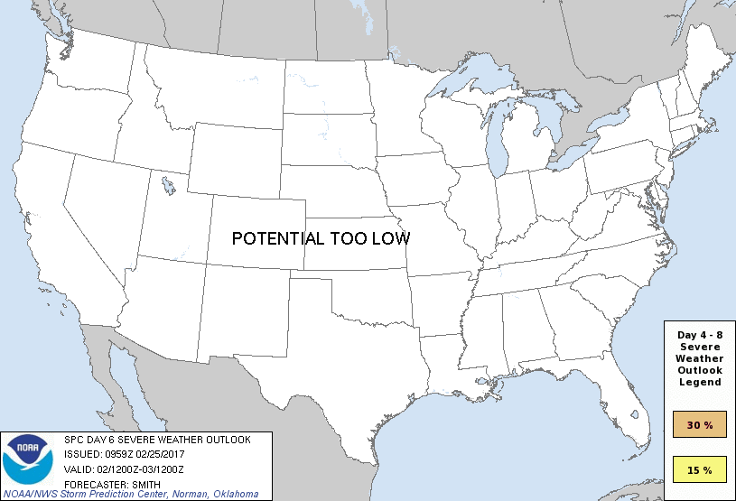
POTENTIAL TOO LOW means the threat for a regional area of organized severe storms appears unlikely (i.e., less than 15%) for the forecast day.
Forecast Discussion
ZCZC SPCSWOD48 ALL
ACUS48 KWNS 250959
SPC AC 250959
Day 4-8 Convective Outlook
NWS Storm Prediction Center Norman OK
0359 AM CST Sat Feb 25 2017
Valid 281200Z - 051200Z
...DISCUSSION...
Severe-thunderstorm potential will focus during the
Tuesday-Wednesday (Days 4-5) period. Medium-range models (GFS,
ECMWF, CMC, UKMET) and ensembles are coming into better agreement
regarding the evolution of a larger-scale mid-level trough moving
from the western states eastward to the MS Valley on Wednesday. The
trough subsequently exits the east coast on Thursday and severe
potential will likely remain low through Saturday (Day 8) as surface
high pressure resides over the central Gulf Coast.
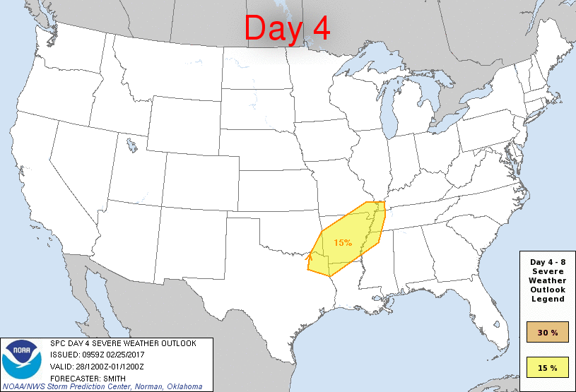
...Arkansas and surrounding states on Tuesday-Tuesday night...
Low-level moisture will contribute to increased buoyancy within a
broad warm-air-advection regime downstream of the mid-level trough.
A cold front is forecast to move into the western part of this area
late Tuesday along with an increasing risk for severe thunderstorms.
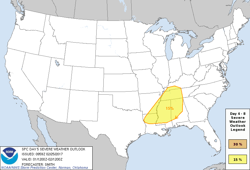
...lower MS Valley and TN Valley on Wednesday...
Strong belt of mid-level flow coupled with increasing low-level
moisture will probably support marginal-moderate buoyancy with a
strong shear profile. The timing of a cold front appears to
converge on Wednesday as it sweeps through the area. Scattered to
numerous thunderstorms are forecast, some of which could be severe.
..Smith.. 02/25/2017
CLICK TO GET WUUS48 PTSD48 PRODUCT


 @NWSSPC