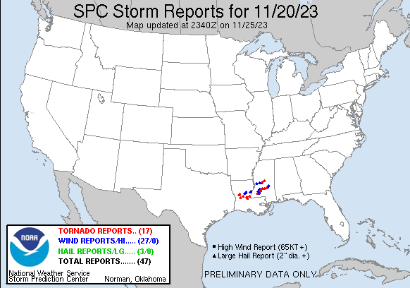
| Tornado Reports (CSV) (Raw Tornado CSV)(?) |
|---|
Time | | Location | County | State | Lat | Lon | Comments |
| 2032 | | 18 S Natchez | Natchitoches | LA | 3141 | 9303 | An EF-1 tornado with estimated maximum winds near 105 mph touched down in extreme Southern Natchitoches Parish in the Kisatchie National Forest along Forest Road 306 ... (SHV) |
| 2040 | | 15 WSW Colfax | Natchitoches | LA | 3144 | 9295 | Around 2:40 PM CST ... NWS Doppler radar indicated a possible tornado on the ground ... with a debris signature evident. This tornado produced structural damage and downe (SHV) |
| 2317 | | 4 SSE Lacamp | Vernon | LA | 3110 | 9288 | First noticable damage is near Sandhill Road Southeast of the intersection of Joe Smith Rd. It intersected Joe Smith Road and Crossed Cora Road. The last visible damage (LCH) |
| 2358 | | 5 NW Woodworth | Rapides | LA | 3120 | 9256 | Weak tornado started just west of forest road 212 and moved east southeast across Oden lake producing minor tree damage The damage ends jus to the east of HWY 165. rate (LCH) |
| 0003 | | 2 W Shoccoe | Madison | MS | 3262 | 8993 | This corrects the previous tornado report from 2 WNW Shoccoe. An NWS storm survey team found an EF-1 rated tornado with a path length of 2.2 miles ... width of 440 yards (JAN) |
| 0027 | | 4 ESE Wesson | Lincoln | MS | 3168 | 9034 | An EF1 tornado with a maximum speed of 90 mph touched down in northeastern Lincoln County on the west side of Lincoln Lake where it snapped small trees. It tracked just (JAN) |
| 0032 | | 3 WSW Pinola | Simpson | MS | 3186 | 9000 | A brief EF0 tornado touched down near Williams Creek in Simpson County. The tornado moved northeast crossing highway 28 and moved into a wooded area north of highway 28 (JAN) |
| 0036 | | 3 S Stronghope | Lincoln | MS | 3170 | 9027 | TDS noted along Timberlane Rd. (JAN) |
| 0036 | | 1 E Ofahoma | Leake | MS | 3271 | 8968 | An NWS storm survey team determined this brief tornado near Highway 16 had a peak windspeed of 76 mph. It snapped one tree and uprooted another tree. (JAN) |
| 0043 | | 3 NW Pinola | Simpson | MS | 3190 | 9000 | TDS noted along Jupiter Rd ... just N of Hwy 28. (JAN) |
| 0055 | | 1 WNW Marksville | Avoyelles | LA | 3113 | 9207 | The tornado started along North Lee St (just south of the intersection with Tarleton St) with damage to trees ... power lines ... and roofs. The path continued across HWY (LCH) |
| 0120 | | 1 E Cottonport | Avoyelles | LA | 3099 | 9204 | The tornado began over northeast Cottonport near the intersection of Lana St and Zion St where homes sustained substantial roof and carport damage while multiple tree b (LCH) |
| 0140 | | 11 SE Acme | Concordia | LA | 3119 | 9168 | An EF1 tornado tracked across far southern Concordia Parish ... tracking along LA Highway 910 and crossing LA Highway 15. Considerable hardwood and cedar tree damage occ (JAN) |
| 0143 | | 3 S Sanatorium | Simpson | MS | 3186 | 8978 | A tornado briefly touched down near Golf Course Road near Sanatorium where some large limbs and small trees were downed. Its maximum wind speed was 70 mph. Its maximum (JAN) |
| 0144 | | Sanatorium | Simpson | MS | 3189 | 8978 | TDS noted. (JAN) |
| 0209 | | 1 SSW Center Ridge | Smith | MS | 3194 | 8948 | This tornado touched down in the Center Ridge community along county road 87 and tracked northeast for nearly 3 miles. Most of the damage was in the form of damaged tre (JAN) |
| 0320 | | 8 SE Bude | Franklin | MS | 3139 | 9075 | This tornado began west of Allen Rd between Freeman Rd and Bowlin Rd near the Smithdale community. As it crossed Freeman Rd ... a sizable portion of the roof of a brick (JAN) |
| Hail Reports (CSV) (Raw Hail CSV)(?) |
|---|
Time | Size | Location | County | State | Lat | Lon | Comments |
| 2226 | 175 | 2 S Clayton | Concordia | LA | 3169 | 9154 | (JAN) |
| 2230 | 125 | Ferriday | Concordia | LA | 3163 | 9156 | (JAN) |
| 0025 | 150 | Martinsville | Copiah | MS | 3179 | 9041 | (JAN) |
| Wind Reports (CSV) (Raw Wind CSV)(?) |
|---|
Time | Speed | Location | County | State | Lat | Lon | Comments |
| 2126 | UNK | 5 SSW Midway | La Salle | LA | 3161 | 9218 | A couple trees and power lines were downed on Benelbie Road. (SHV) |
| 2126 | UNK | 5 SSW Midway | La Salle | LA | 3162 | 9218 | A few trees and power lines were downed near the intersection of Nebo Belah Road and Clyde Road. (SHV) |
| 2220 | UNK | Ferriday | Concordia | LA | 3163 | 9156 | A large tree fell on a truck near Ferriday. (JAN) |
| 2233 | UNK | 3 NE Ferriday | Concordia | LA | 3167 | 9152 | Trees down and lines down NE of Ferriday. (JAN) |
| 2234 | UNK | 1 NW Spokane | Concordia | LA | 3170 | 9146 | NWS Survey team found a substantial number of branches down and plentiful leaf litter. Minor tin peeling on a few shed/barn structures. Damage was strewn west to east. (JAN) |
| 2245 | UNK | 1 NNE Oak Ridge | Warren | MS | 3250 | 9070 | A couple trees down on Oak Ridge Rd. (JAN) |
| 2305 | UNK | 4 ESE Pollock | Grant | LA | 3149 | 9234 | A tree was blown down on Walker Ferry Road southeast of Pollock. (SHV) |
| 2323 | UNK | 1 NE Flora | Madison | MS | 3256 | 9030 | A few trees were down off Harris Road. (JAN) |
| 2338 | 60 | 1 NNW Gluckstadt | Madison | MS | 3253 | 9010 | (JAN) |
| 0000 | UNK | 1 ESE Caseyville | Lincoln | MS | 3167 | 9064 | Trees downed along MS 550. (JAN) |
| 0011 | UNK | Hazlehurst | Copiah | MS | 3186 | 9039 | Swath of damaging straight line winds occurred across the city of Hazlehurst. Numerous trees were downed and vegetation damaged. Some structures received mostly minor r (JAN) |
| 0019 | UNK | Hazlehurst | Copiah | MS | 3186 | 9040 | A tree fell on a home on Gallatin St. (JAN) |
| 0019 | UNK | 1 WNW Hazlehurst | Copiah | MS | 3187 | 9040 | Trees downed on Magnolia St. (JAN) |
| 0019 | UNK | 1 NNW Hazlehurst | Copiah | MS | 3188 | 9039 | Tree downed on MS Highway 28 near Jackson St. (JAN) |
| 0019 | UNK | 1 NNW Hazlehurst | Copiah | MS | 3188 | 9040 | Minor damage to a gas station at US 51 and MS 28. (JAN) |
| 0020 | 60 | 1 WNW Hazlehurst | Copiah | MS | 3187 | 9041 | 60+ mph est gusts ... debris blowing around. (JAN) |
| 0022 | UNK | 2 ENE Hazlehurst | Copiah | MS | 3187 | 9036 | Powerlines down near hwy 28 east of Hazlehurst. (JAN) |
| 0022 | UNK | 2 ENE Hazlehurst | Copiah | MS | 3187 | 9037 | Metal roof blown off a building at MS 28 and Bethesda Rd. (JAN) |
| 0022 | UNK | 2 ENE Hazlehurst | Copiah | MS | 3188 | 9037 | Large trees down at Bethesda Rd and Daniels Ln. (JAN) |
| 0028 | UNK | 5 W Georgetown | Copiah | MS | 3187 | 9025 | Tree and powerlines downed across MS Highway 28. (JAN) |
| 0144 | UNK | Sanatorium | Simpson | MS | 3190 | 8978 | Multiple downed trees across Simpson County. Report via social media. (JAN) |
| 0153 | UNK | 4 N Bogue Chitto | Lincoln | MS | 3149 | 9046 | Some trees and power lines down. (JAN) |
| 0210 | UNK | 1 NNW Center Ridge | Smith | MS | 3195 | 8948 | A few trees were down or damaged along Highway 37 ... scr 86 and Mineral Springs roads. This was wind damage not associated with the Center Ridge tornado ... but with the (JAN) |
| 0224 | UNK | 3 SSW Louin | Jasper | MS | 3203 | 8927 | Trees and power lines downed on MS 15 between Bay Springs and Louin. (JAN) |
| 0237 | UNK | 5 E Montrose | Jasper | MS | 3212 | 8915 | Trees down on CR 20 near CR 2012. (JAN) |
| 0322 | UNK | 8 SSE Eddiceton | Franklin | MS | 3140 | 9074 | Mobile home had porch damaged ... trees down ... metal shed damaged ... possible tornado. (JAN) |
| 0342 | UNK | 5 NE Auburn | Lincoln | MS | 3142 | 9056 | Numerous pines uprooted ... one on home. Several snaps. (JAN) |


 @NWSSPC