20110131's Storm Report (1200 UTC - 1159 UTC)
|
< 110130 Reports
110201 Reports >
|
|
| Note: All data are considered preliminary |
| Tornado Reports (CSV) (Raw Tornado CSV)(?) |
|---|
| No reports received |
| Hail Reports (CSV) (Raw Hail CSV)(?) |
|---|
| No reports received |
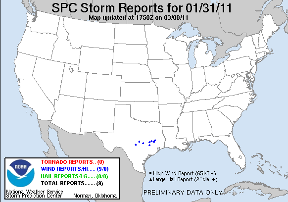
| Wind Reports (CSV) (Raw Wind CSV)(?) |
|---|
Time | Speed | Location | County | State | Lat | Lon | Comments |
| 0810 | 60 | 3 SW FREDERICKSBURG | GILLESPIE | TX | 3024 | 9891 | ASSOCIATED WITH FRONTAL PASSAGE. TSTMS IN AREA. (EWX) |
| 0830 | UNK | BURNET | BURNET | TX | 3076 | 9823 | ROOFS BLOWN OFF OR DAMAGED, TREES DOWN, POWER LINES AND POWER POLES DAMAGED. STRONG WINDS, MODERATE HAIL REPORTD ALSO. (EWX) |
| 0915 | 70 | 4 NE PFLUGERVILLE | TRAVIS | TX | 3048 | 9757 | REPORTED ON THE FRONTAL PASSAGE WITH THUNDERSTORMS IN THE AREA. OTHER GUSTS TO 50 RECORDED. (EWX) |
| 1040 | UNK | BRYAN | BRAZOS | TX | 3067 | 9637 | MEDIA REPORTED A ROOF WAS BLOWN OFF A MOBILE HOME. (HGX) |
| 1100 | UNK | IOLA | GRIMES | TX | 3077 | 9607 | NUMEROUS TREES DOWN WITHIN GRIMES COUNTY. (HGX) |
| 1105 | UNK | BRENHAM | WASHINGTON | TX | 3016 | 9640 | NUMEROUS TREES DOWNED - ESTIMATED 60-70 MPH WINDS. (HGX) |
| 1130 | UNK | 10 W HUNTSVILLE | WALKER | TX | 3071 | 9572 | TIN ROOF DAMAGED ON HOME ON LOMA ROAD. (HGX) |
| 1150 | UNK | TRINITY | TRINITY | TX | 3094 | 9537 | SHERIFFS OFFICE REPORTED SEVERAL TREES DOWN ON HWY 356, HWY 19, HWY 287. ROOFS BLOWN OFF HOUSES IN TRINITY. (HGX) |
| 1159 | UNK | HUNTSVILLE | WALKER | TX | 3071 | 9555 | LARGE TREE DOWN BLOCKING ROAD IN HUNTSVILLE. (HGX) |
| Full report
in comma-separated values (CSV) format and in KML format. |
| Raw full report
in comma-separated values (CSV) format |
| Fields marked UNK are unknown |
| All Times UTC |
| Wind Gusts in MPH |
| Hail Sizes in 1/100 of an Inch (175 = 1.75") |
| LAT/LON in decimal degrees to two decimals, see SPC FAQ for more info |
| List of Weather Forecast Office 3-letter IDs appear in the report comments section |
|
|
|
Top/Storm Reports/Home
|


 @NWSSPC