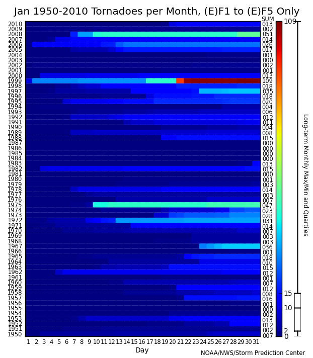
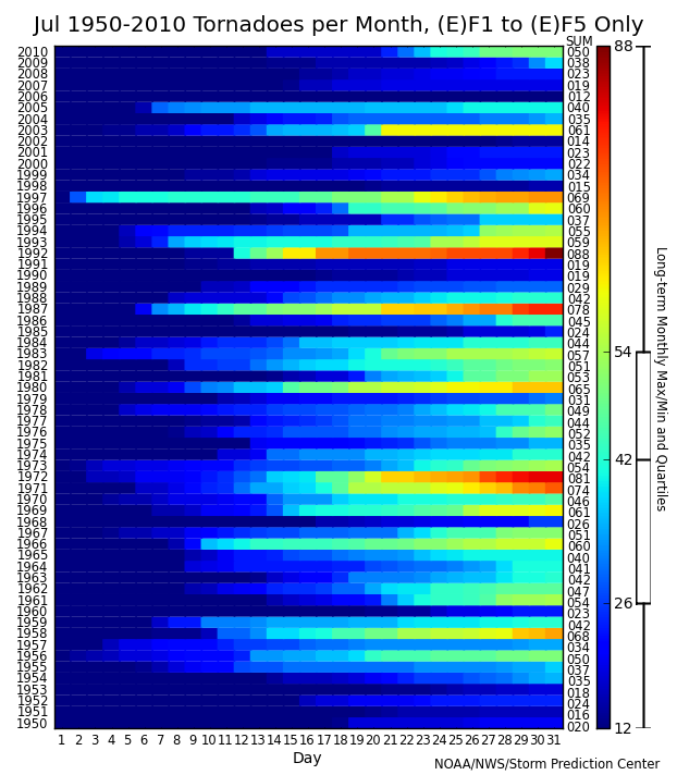
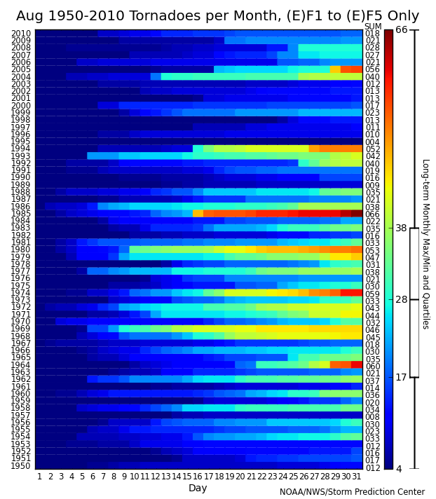
U.S. Monthly Tornado Summary Charts 1950-2010 (F1 to F5 only)
This page contains a table, or calendar, of monthly tornado summaries for each year from 1950 through 2010 (61 years). The chart for each month has the days of the month along the x-axis and the years since 1950 increasing along the y-axis. The color changes from blue to dark red (cold to hot) along each horizontal bar as the sum of tornadoes for the month in each year increases. The range of colors for each month is normalized to the range of observed values for that month. In other words, light blue in June (~80 tornadoes) is not the same as light blue in December (~30 tornadoes). Monthly tornado sums for each year are shown under the column labeled (SUM) on the right side of the chart. Also on the right side of each chart is the color-bar indicating the range of observed values for that month over the 61 year period. The tick marks shown on the color-bar correspond to the minimum, maximum and quartile values for that month, computed over the entire 61 year record, and also serve as the tick marks for the box-and-whisker plot on the far right-hand side of each chart.
Summing tornadoes rated (E)F-1 and stronger, and not counting (E)F-0 tornadoes for this analysis, is based on the fact that (E)F-0 tornadoes have been increasing substantially in recent years due to changes in NWS verification and reporting procedures. Not counting the weakest tornadoes eliminates some of the problems associated with report inflation and provides a more representative and somewhat more realistic look at the high variability that exists in tornado events from month to month, and from year to year.
For additional information please contact Greg Carbin at SPC.
Reference: Verbout, Stephanie M., Harold E. Brooks, Lance M. Leslie, David M. Schultz, 2006: Evolution of the U.S. tornado database: 1954-2003. Wea. Forecasting, 1, 86-93.
Mouse over image to see month. Click on image for full resolution chart.


 Back to Storm Prediction Center WCM page
