SPC AC 270729
Day 3 Convective Outlook
NWS Storm Prediction Center Norman OK
0229 AM CDT Sat Apr 27 2024
Valid 291200Z - 301200Z
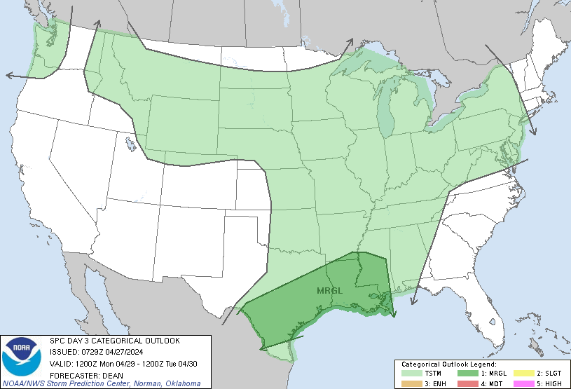
...THERE IS A MARGINAL RISK OF SEVERE THUNDERSTORMS FROM
CENTRAL/SOUTH TX INTO THE LOWER MS VALLEY...
...SUMMARY...
Isolated strong to severe thunderstorms will be possible on Monday
from parts of central and south Texas into the lower Mississippi
Valley.
...Synopsis...
A shortwave trough initially near the upper Great Lakes region is
forecast to gradually weaken and move northeastward on Monday. In
its wake, a low-amplitude shortwave trough is forecast to move
across the southern Plains. Across the west, a shortwave trough and
related mid/upper-level jet will move through the Northwest toward
the northern Rockies by Monday evening.
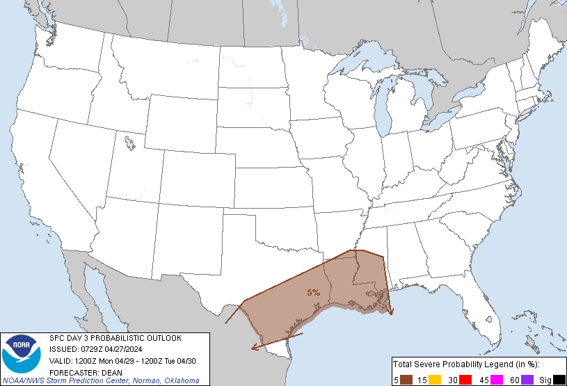
...ArkLaTex into the Lower MS Valley...
A storm cluster may be ongoing somewhere near the ArkLaTex region
Monday morning, aided by a persistent low-level jet and the
approaching low-amplitude shortwave trough. The eastward progression
of any such cluster and magnitude of downstream destabilization
remain quite uncertain, but some threat for isolated hail, damaging
wind, and possibly a tornado could spread into the lower MS Valley
through the day.
...Parts of central/south TX...
An outflow reinforced front may move into parts of central TX early
Monday, in the wake of extensive ongoing convection father east.
This front will may stall and either begin moving northward by
afternoon, or just become increasingly ill-defined with time. While
stronger ascent will move east/northeast of this region, strong
heating of a moist airmass will result in moderate to locally strong
destabilization, and isolated storm development will be possible.
Deep-layer shear will remain sufficient for some storm organization,
so any sustained development would pose a threat for hail and
isolated severe gusts.
...Parts of the Mid MS and OH Valleys into the lower Great Lakes
region...
A weakening cold front will move through parts of the Mid MS and OH
Valleys during the day on Monday, with the front expected to reach
parts of the lower Great Lakes by Monday evening. While moderate
deep-layer flow may persist along/ahead of the front,
destabilization may be quite limited due to considerable cloudiness
and weakening midlevel lapse rates. While a strong storm or two
cannot be ruled out along/ahead of the front, uncertainty regarding
the development of adequate instability precludes probabilities at
this time.
..Dean.. 04/27/2024
CLICK TO GET WUUS03 PTSDY3 PRODUCT
NOTE: THE NEXT DAY 3 OUTLOOK IS SCHEDULED BY 0730Z