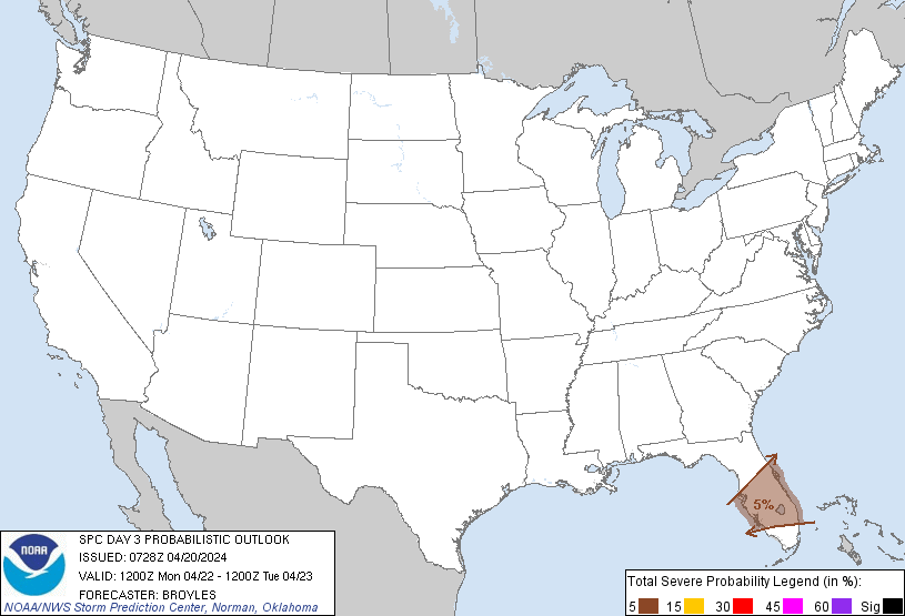
Tampa, FL...St. Petersburg, FL...Orlando, FL...Cape Coral, FL...Port St. Lucie, FL...
Probabilistic Graphic
Probability of severe weather within 25 miles of a point. Hatched Area: 10% or greater probability of significant severe within 25 miles of a point.
Day 3 Prob. Risk
Area (sq. mi.)
Area Pop.
Some Larger Population Centers in Risk Area
5 %
24,402
10,101,387
Orlando, FL...Coral Springs, FL...Cape Coral, FL...Port St. Lucie, FL...West Palm Beach, FL...
SPC AC 200728
Day 3 Convective Outlook
NWS Storm Prediction Center Norman OK
0228 AM CDT Sat Apr 20 2024
Valid 221200Z - 231200Z
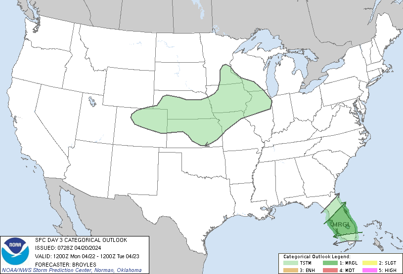
...THERE IS A MARGINAL RISK OF SEVERE THUNDERSTORMS ACROSS THE
FLORIDA PENINSULA...
...SUMMARY...
Strong thunderstorms, capable of marginally severe wind gusts and
hail, will be possible across the Florida Peninsula on Monday.
...Florida Peninsula...
An upper-level trough will move eastward to the Atlantic Seaboard on
Monday, as a cold front advances southward across the Florida
Peninsula. The airmass south of the front, in central and south
Florida, will have surface dewpoints in the 60s F. Surface heating
and low-level convergence in the vicinity of the front will result
in thunderstorm development during the afternoon. Forecast soundings
at 21Z on Monday near the front in south-central Florida have MLCAPE
near 1500 J/kg, moderate deep-layer shear, 0-3 km lapse rates around
7 C/km, and steep lapse rates in the 700 to 500 mb layer. This
should support a marginal severe threat, with the primary hazards
isolated damaging wind gusts and hail. The threat will likely be
greatest in the mid to late afternoon.
..Broyles.. 04/20/2024
CLICK TO GET WUUS03 PTSDY3 PRODUCT
NOTE: THE NEXT DAY 3 OUTLOOK IS SCHEDULED BY 0730Z