SPC AC 170730
Day 3 Convective Outlook
NWS Storm Prediction Center Norman OK
0230 AM CDT Wed Apr 17 2024
Valid 191200Z - 201200Z
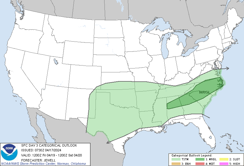
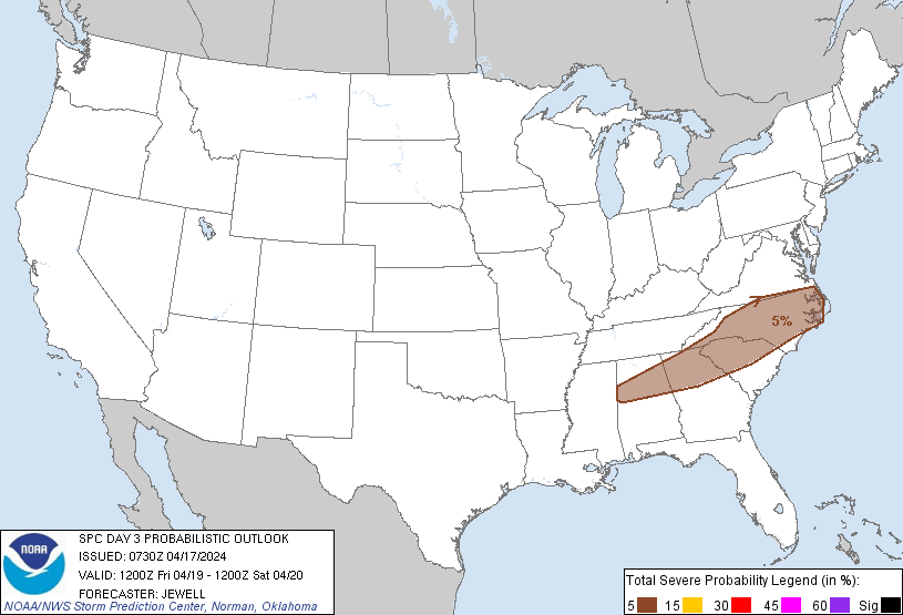
...THERE IS A MARGINAL RISK OF SEVERE THUNDERSTORMS FROM NORTH
CAROLINA INTO NORTHERN GEORGIA AND ALABAMA...
...SUMMARY...
Sporadic strong to marginally severe storms are possible on Friday
over parts of the Southeast.
...Synopsis...
A large but low-amplitude upper trough will exist from the northern
Rockies east across the northern Plains, upper MS Valley, and Great
Lakes, with an upper low deepening over Ontario. Moderate midlevel
westerlies will exist across much of the Plains into the OH Valley,
with much weaker winds aloft from TX into the Southeast. Meanwhile,
a weaker wave is expected to move across parts of the Southwest
early on Saturday.
At the surface, high pressure will be prominent across the central
and northern Plains as well as the MS and OH Valleys, with a cold
front roughly stretching from central TX to the Appalachians. A
moist air mass will exist south of this front, from TX eastward
across the Gulf Coast states. Given a strong area of high pressure
to the north, this front should continue to progress generally
southward through the period.
...The Frontal Zone from TX to the Carolinas...
Scattered thunderstorms may linger from OH into eastern TN Friday
morning near the front, with generally weak instability at that time
and no severe threat expected. Other storms will form as heating
occurs and the front interacts with moisture over the Carolinas.
Around 1000 J/kg MLCAPE appears reasonable, beneath modest
west/northwest flow aloft. Forecast soundings depict a deeply mixed
boundary layer conducive for strong gusts while hodographs appear
sufficiently long for cellular storm mode, and thus marginal hail
risk. This threat should extend westward across parts of GA and AL
near the front as well for daytime isolated severe wind or hail.
Farther west, a large area of elevated instability will exist over
the southern Plains, well north of the surface front from eastern TX
to the middle Rio Grande Valley. Overall lift is expected to be weak
in this region, with lesser heating potential and weak shear. The
greatest chance of general thunderstorms here may be overnight near
the 850 mb boundary from southwest TX to the Red River. Small hail
cannot be ruled out given ample elevated CAPE.
..Jewell.. 04/17/2024
CLICK TO GET WUUS03 PTSDY3 PRODUCT
NOTE: THE NEXT DAY 3 OUTLOOK IS SCHEDULED BY 0730Z