SPC AC 150724
Day 3 Convective Outlook
NWS Storm Prediction Center Norman OK
0224 AM CDT Mon Apr 15 2024
Valid 171200Z - 181200Z
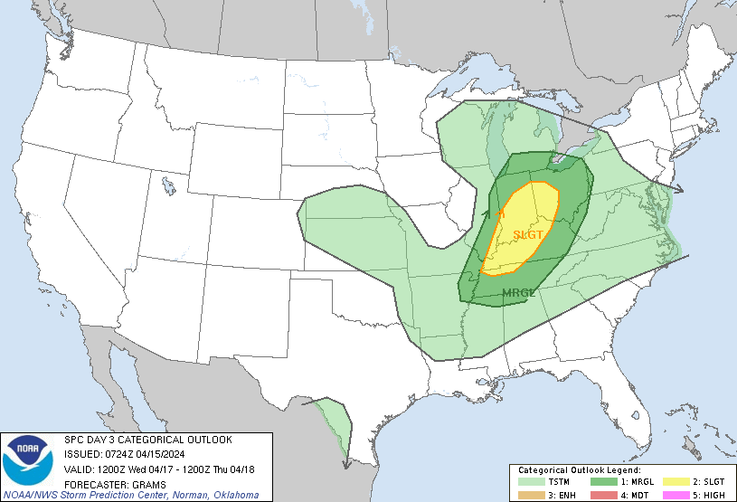
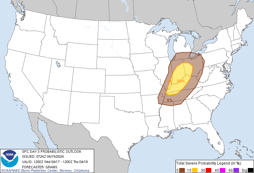
...THERE IS A SLIGHT RISK OF SEVERE THUNDERSTORMS IN PARTS OF THE
LOWER OH VALLEY TO MID-SOUTH...
...SUMMARY...
Scattered severe thunderstorms are possible on Wednesday afternoon
to early evening across parts of the Lower to Central Ohio Valley
into the Mid-South.
...Parts of the Midwest to Mid-South...
Occluding surface cyclone in the northeast IA vicinity on Wednesday
morning will further dampen as it tracks towards Lower MI. Despite
weakening tropospheric flow fields, favorable low to deep-layer
shear profiles should persist into early evening. The northeast lobe
of the warm-moist sector emanating from the western Gulf should
spread across at least the Lower OH Valley. While some low-level
warm theta-e advection-driven convection may be ongoing at 12Z
Wednesday, overall signals have been for less convection impacting
the buoyancy plume compared to prior forecasts. As such, potential
for greater daytime destabilization is apparent, with a moderate
MLCAPE field from 1000-2000 J/kg likely. Most guidance suggests
early afternoon convective initiation will occur along the cold
front trailing south-southwest from the occluding cyclone. A mix of
all severe hazards appears possible with both supercells and
multicell clusters. Greatest convective concentration is expected
near/north of the Lower to Central Ohio Valley. The buoyancy plume
should be more confined within this corridor and eventually pinch
off as overturning occurs. With further diminishing of flow fields
into the evening, the severe threat will wane after dusk.
..Grams.. 04/15/2024
CLICK TO GET WUUS03 PTSDY3 PRODUCT
NOTE: THE NEXT DAY 3 OUTLOOK IS SCHEDULED BY 0730Z