SPC AC 120728
Day 3 Convective Outlook
NWS Storm Prediction Center Norman OK
0228 AM CDT Fri Apr 12 2024
Valid 141200Z - 151200Z
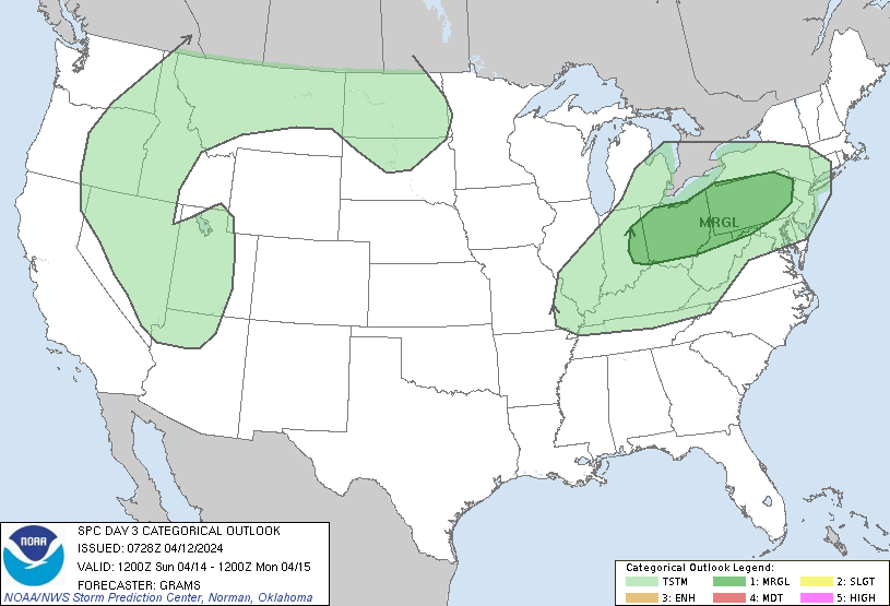
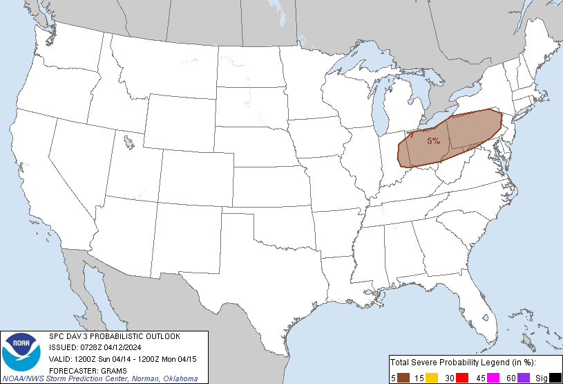
...THERE IS A MARGINAL RISK OF SEVERE THUNDERSTORMS FROM PA TO EAST
IN...
...SUMMARY...
Isolated severe thunderstorms are possible on Sunday, mainly from
late afternoon into the evening, across Pennsylvania to eastern
Indiana.
...PA to eastern IN...
A mid-level jetlet attendant to a low-amplitude shortwave impulse
should progress across the northern Great Lakes and Ontario into New
England by Sunday evening. To its south-southwest, a pronounced
elevated mixed layer across the Midwest and southern Great Lakes
will shift southeastward into the Mid-Atlantic and Southeast States.
This elevated mixed layer will likely cap surface-based convection
until peak heating along a southeast-sagging cold front. 00Z NAM
soundings appear relatively reasonable with this evolution as
modified low-level moisture return emanating from the southern Great
Plains struggles to reduce MLCIN until cooling aloft spreads in from
the west-northwest.
MLCAPE should eventually reach 500-1000 J/kg over IN/OH, with
progressively weaker values over PA. Hodographs across the region
should be dominated by low-level curvature enlargement, with little
speed or directional shear component above that within the buoyancy
layer. Seemingly, a west/east-oriented cluster along the front
should develop by late afternoon to early evening and move south
with the undercutting front, while embedded cells attempt to
parallel the deep-layer west-northwesterly flow regime. This setup
appears to favor low probabilities across each of the hazards into
Sunday evening. The western extent of the threat into IN will likely
be modulated by progressively greater MLCIN that may not be
eliminated prior to frontal passage.
..Grams.. 04/12/2024
CLICK TO GET WUUS03 PTSDY3 PRODUCT
NOTE: THE NEXT DAY 3 OUTLOOK IS SCHEDULED BY 0730Z