Oklahoma City, OK...Tulsa, OK...Lubbock, TX...Norman, OK...Midland, TX...
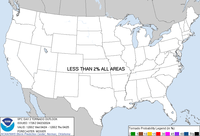
Probabilistic Tornado Graphic
Probability of a tornado within 25 miles of a point. Hatched Area: 10% or greater probability of EF2 - EF5 tornadoes within 25 miles of a point.
Day 2 Tornado Risk
Area (sq. mi.)
Area Pop.
Some Larger Population Centers in Risk Area
No Risk Areas Forecast
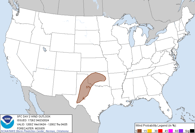
Probabilistic Damaging Wind Graphic
Probability of damaging thunderstorm winds or wind gusts of 50 knots or higher within 25 miles of a point. Hatched Area: 10% of greater probability of wind gusts 65 knots or greater within 25 miles of a point.
Day 2 Wind Risk
Area (sq. mi.)
Area Pop.
Some Larger Population Centers in Risk Area
5 %
73,141
3,401,201
Oklahoma City, OK...Tulsa, OK...Lubbock, TX...Norman, OK...Midland, TX...
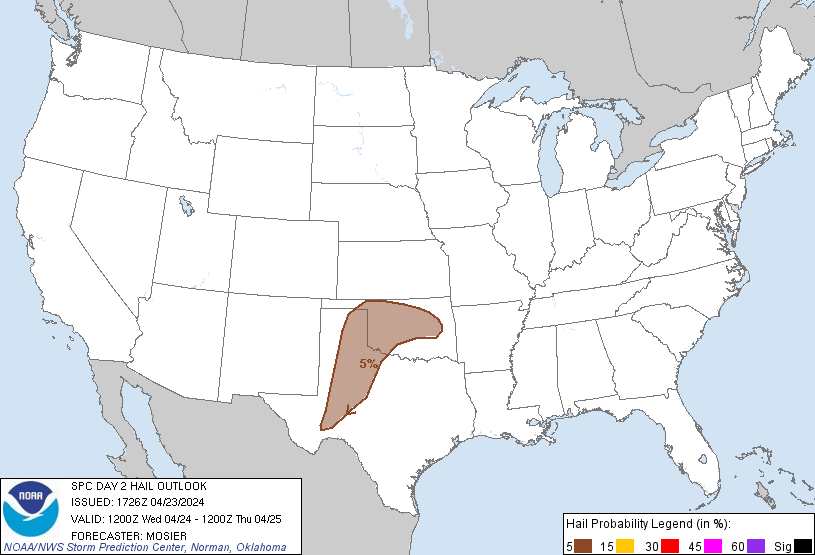
Probabilistic Large Hail Graphic
Probability of hail 1" or larger within 25 miles of a point. Hatched Area: 10% or greater probability of hail 2" or larger within 25 miles of a point.
Day 2 Hail Risk
Area (sq. mi.)
Area Pop.
Some Larger Population Centers in Risk Area
5 %
83,625
3,515,280
Oklahoma City, OK...Tulsa, OK...Lubbock, TX...Norman, OK...Midland, TX...
SPC AC 231726
Day 2 Convective Outlook
NWS Storm Prediction Center Norman OK
1226 PM CDT Tue Apr 23 2024
Valid 241200Z - 251200Z
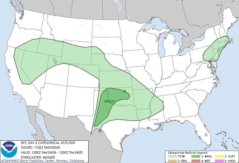
...THERE IS A MARGINAL RISK OF SEVERE THUNDERSTORMS FROM WEST TEXAS
INTO MUCH OF OKLAHOMA...
...SUMMARY...
Strong thunderstorms will be possible on Wednesday across parts of
Oklahoma and west Texas. Isolated hail and severe gusts will be the
primary hazards.
...Synopsis...
Upper pattern is expected to feature a shortwave trough from western
Quebec through western New York early Wednesday, with another
shortwave well off the southern CA Coast. Shortwave ridging is
anticipated between these two troughs. This entire
trough/ridge/trough pattern is forecast to move eastward during the
period, with the eastern shortwave trough moving off the
Northeast/New England coast by Wednesday evening, and the western
shortwave trough making steady eastward progress, likely extending
from southern NV into southwest AZ/far northwest Mexico by early
Thursday morning. Shortwave ridging will be maintained between these
troughs, ending the period over the Great Plains.
At the surface, a cold front associated with the Northeast shortwave
will progress quickly eastward, moving off the Northeast coast by
the late afternoon and off the Mid-Atlantic coast later during the
evening. Farther west, modest lee troughing is anticipated early
Wednesday, with a weak surface low likely over the Texas
Trans-Pecos. Lee troughing is expected to sharpen throughout the
day, with the surface low likely deepening as well. At the same
time, persistent low-level theta-e advection across TX will
contribute to the sharpening of a stalled frontal boundary from the
southeast TX Panhandle across southern OK. By late Wednesday
night/early Thursday morning, this front will likely begin pushing
northward across the eastern TX Panhandle and OK as a warm front.
...Eastern TX/OK Panhandles into central OK early Wednesday...
Elevated thunderstorms may be ongoing early Wednesday morning from
the northeast TX/eastern OK Panhandles into central/north-central OK
within the warm-air advection regime along the northeastern edge of
the returning low-level moisture. Gradually strengthening westerly
flow aloft will support enough vertical shear for organized updrafts
and the potential for some storms strong enough to produce large
hail. Background height rises cast some doubts for overall storm
severity, but thunderstorms will likely persist into the afternoon
as they move generally southeastward.
...TX Panhandle through Permian Basin Wednesday afternoon...
Low-level moisture is forecast to advect northwestward into the
southern High Plains throughout the day. As such, low 60s dewpoints
are expected from the TX Panhandle southward to the Big Bend by the
early afternoon. Even so, mid-level temperatures and associated
capping will likely preclude widespread deep convection. Some
isolated development does appear probable, particularly where
persistent low-level convergence favors multiple attempts at storm
development. Given strong buoyancy and deep-layer vertical shear,
any convection that is maintained and matures should become
supercellular with the potential to produce large to very large hail
and strong, damaging downdrafts.
...TX Panhandle into OK Wednesday night into Thursday morning...
Another round of elevated convection is possible from the southern
TX Panhandle into northwest TX into OK late Wednesday night into
Thursday morning, as low to mid-level moisture spreads northward in
advance of the approaching upper trough. Moderate elevated buoyancy
and sufficient effective shear could support an isolated hail threat
within any more established storms.
...Northern Mid-Atlantic into Southern New England...
Shallow convection is anticipated along and in the wake of the cold
front forecast to move quickly eastward/southeastward across the
region. Shallow nature to the convection should keep lightning
isolated, but a few damaging gusts are still possible as downdrafts
augment the moderate westerly low-level flow in place.
..Mosier.. 04/23/2024
CLICK TO GET WUUS02 PTSDY2 PRODUCT
NOTE: THE NEXT DAY 2 OUTLOOK IS SCHEDULED BY 0600Z