Oklahoma City, OK...Tulsa, OK...Norman, OK...Midland, TX...Lawton, OK...
Probabilistic Tornado Graphic
Probability of a tornado within 25 miles of a point. Hatched Area: 10% or greater probability of EF2 - EF5 tornadoes within 25 miles of a point.
Day 2 Tornado Risk
Area (sq. mi.)
Area Pop.
Some Larger Population Centers in Risk Area
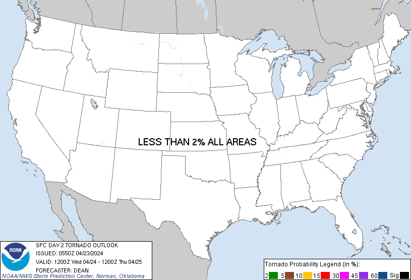
No Risk Areas Forecast
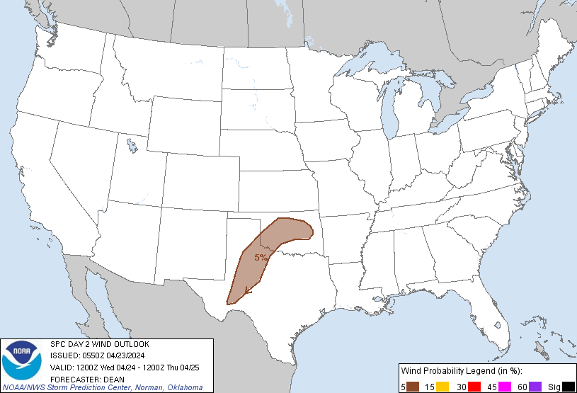
Probabilistic Damaging Wind Graphic
Probability of damaging thunderstorm winds or wind gusts of 50 knots or higher within 25 miles of a point. Hatched Area: 10% of greater probability of wind gusts 65 knots or greater within 25 miles of a point.
Day 2 Wind Risk
Area (sq. mi.)
Area Pop.
Some Larger Population Centers in Risk Area
5 %
63,433
3,069,631
Oklahoma City, OK...Tulsa, OK...Norman, OK...Midland, TX...Lawton, OK...
Probabilistic Large Hail Graphic
Probability of hail 1" or larger within 25 miles of a point. Hatched Area: 10% or greater probability of hail 2" or larger within 25 miles of a point.
Day 2 Hail Risk
Area (sq. mi.)
Area Pop.
Some Larger Population Centers in Risk Area
5 %
63,433
3,069,631
Oklahoma City, OK...Tulsa, OK...Norman, OK...Midland, TX...Lawton, OK...
SPC AC 230550
Day 2 Convective Outlook
NWS Storm Prediction Center Norman OK
1250 AM CDT Tue Apr 23 2024
Valid 241200Z - 251200Z
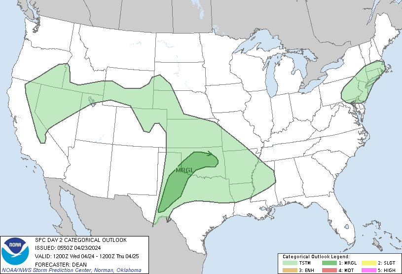
...THERE IS A MARGINAL RISK OF SEVERE THUNDERSTORMS ACROSS PARTS OF
OKLAHOMA AND WEST TEXAS...
...SUMMARY...
Strong thunderstorms will be possible on Wednesday across parts of
Oklahoma and west Texas. Isolated hail and severe gusts will be the
primary hazards.
...Synopsis...
An upper-level trough initially off of the southern CA/Baja coast is
forecast to move inland on Wednesday, reaching the Southwest by
Thursday morning. A nearly stationary front is forecast to be draped
from west/north TX into parts of the lower MS Valley, with weak
surface troughing expected over the central/southern Plains. Across
the east, an upper-level trough is forecast to move through parts of
the OH Valley into the Mid Atlantic and Northeast, as an attendant
cold front sweeps through New England. Low-topped convection with
locally gusty winds could accompany the front during the afternoon.
...Parts of the southern Great Plains...
An uncertain Marginal Risk has been maintained from parts of west TX
into OK, with some adjustments made based on latest guidance.
Elevated convection may develop or be ongoing across parts of OK
Wednesday morning, within a zone of low-level warm advection along
the northeastern fringe of moderate elevated buoyancy. Any such
convection will tend to move southeastward through the day, north of
stationary front. Steep midlevel lapse rates and marginally
supportive effective shear (for convection likely based between
800-700 mb) could support an isolated hail/wind risk with any
stronger semi-discrete storms.
Farther west, generally weak forcing will likely tend to limit
coverage of diurnal surface-based storms. However, rather strong
heating and diminishing MLCINH could support isolated development
across areas of west/northwest TX near the stationary front, and
southward along a weakly convergent surface trough/dryline. Moderate
to locally strong buoyancy and sufficient deep-layer shear will
result in a conditionally favorable environment, and an isolated
supercell or two could evolve if storms can mature, with a threat
for hail and localized severe gusts.
Finally, another round of elevated convection may develop from
northwest TX into OK late Wednesday night into Thursday morning, as
deeper moisture spreads northward in advance of the approaching
upper trough. Moderate elevated buoyancy and sufficient effective
shear could support an isolated hail threat within this regime.
...Southeast OK toward the ArkLaMiss region...
Modest buoyancy may develop near/south of the nearly stationary
front from southeast OK into the ArkLaMiss Wednesday afternoon.
Elevated convection could spread southeastward north of the boundary
through the day within a weak northwesterly flow regime, while
isolated diurnal storm development will be possible near the
boundary. Uncertainty remains regarding the intensity and coverage
of convection across this region, but a strong storm or two cannot
be ruled out into early evening.
..Dean.. 04/23/2024
CLICK TO GET WUUS02 PTSDY2 PRODUCT
NOTE: THE NEXT DAY 2 OUTLOOK IS SCHEDULED BY 1730Z