Abilene, TX...Wichita Falls, TX...Lawton, OK...Saginaw, MI...Midland, MI...
Probabilistic Tornado Graphic
Probability of a tornado within 25 miles of a point. Hatched Area: 10% or greater probability of EF2 - EF5 tornadoes within 25 miles of a point.
Day 2 Tornado Risk
Area (sq. mi.)
Area Pop.
Some Larger Population Centers in Risk Area
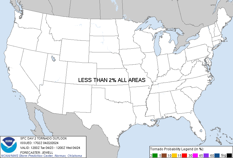
No Risk Areas Forecast
Probabilistic Damaging Wind Graphic
Probability of damaging thunderstorm winds or wind gusts of 50 knots or higher within 25 miles of a point. Hatched Area: 10% of greater probability of wind gusts 65 knots or greater within 25 miles of a point.
Day 2 Wind Risk
Area (sq. mi.)
Area Pop.
Some Larger Population Centers in Risk Area
5 %
56,274
1,946,534
Abilene, TX...Wichita Falls, TX...Lawton, OK...Saginaw, MI...Midland, MI...
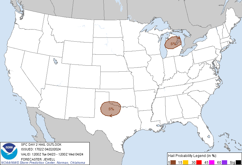
Probabilistic Large Hail Graphic
Probability of hail 1" or larger within 25 miles of a point. Hatched Area: 10% or greater probability of hail 2" or larger within 25 miles of a point.
Day 2 Hail Risk
Area (sq. mi.)
Area Pop.
Some Larger Population Centers in Risk Area
5 %
55,333
1,901,553
Abilene, TX...Wichita Falls, TX...Lawton, OK...Saginaw, MI...Midland, MI...
   SPC AC 221702

   Day 2 Convective Outlook
   NWS Storm Prediction Center Norman OK
   1202 PM CDT Mon Apr 22 2024

   Valid 231200Z - 241200Z

   ...THERE IS A MARGINAL RISK OF SEVERE THUNDERSTORMS OVER NORTHWEST
   TEXAS AND VICINITY...AND OVER PARTS OF LOWER MICHIGAN...

   ...SUMMARY...
   Isolated severe thunderstorms will be possible on Tuesday from parts
   of the Texas Caprock eastward across northwest Texas and far
   southwest Oklahoma, and over parts of Lower Michigan.

   ...Synopsis and Discussion...
   On Tuesday, a northwest flow regime will exist from the Rockies to
   the East Coast, with a strong shortwave trough moving across the
   upper MS Valley, Great Lakes and OH Valley. Temporary ridging will
   occur over the Great Basin before a deep upper trough provides
   height falls into CA late.

   At the surface, high pressure will be centered over GA and SC, which
   will produce dry and stable conditions for much of the region. South
   of the high, low-level moisture trajectories will extend from the
   Bahamas across the southern Gulf of Mexico, with 50s dewpoints
   spreading north into central TX and OK. Another area of high
   pressure will exist over the northern High Plains, with a surface
   trough generally from Lake Huron to northwest TX during the
   afternoon.

   Low pressure will exist ahead of the northern trough near Lake
   Huron, with another developing low over the TX Panhandle/South
   Plains area, just south of a front. This front will extend
   northeastward from the low across OK, southern MO, and to the OH
   Valley, with instability focused over northwest TX.  Minimal
   instability may also develop over Lower MI.

   ...Northwest TX and Vicinity...
   Strong heating will occur near the developing low and south of the
   southwest-northeast oriented front. Weak northwest flow aloft will
   couple with veering low-level winds to favor a few severe storms
   capable of hail and strong gusts near peak heating. Forecast
   soundings reveal straight hodographs, which will favor cellular
   storm mode. Steep lapse rates will favor hail while the deeply mixed
   boundary layer supports strong outflow as well.

   ...Lower Michigan...
   Strong midlevel cooling will occur across the upper Great Lakes
   region as the upper trough pushes southeast. Combined with daytime
   heating, this will yield very steep lapse rates which will favor
   strong storms despite only 40s F dewpoints. Convergence along the
   front looks to be favorably timed with peak heating, with scattered
   low-topped storms expected. Given very cold 500 mb temperatures to
   -25 C, hail will be likely, with a few storms perhaps capable of
   hail to severe levels.

   ..Jewell.. 04/22/2024

   CLICK TO GET WUUS02 PTSDY2 PRODUCT

   NOTE: THE NEXT DAY 2 OUTLOOK IS SCHEDULED BY 0600Z