Probability of a tornado within 25 miles of a point. Hatched Area: 10% or greater probability of EF2 - EF5 tornadoes within 25 miles of a point.
Day 2 Tornado Risk
Area (sq. mi.)
Area Pop.
Some Larger Population Centers in Risk Area
No Risk Areas Forecast
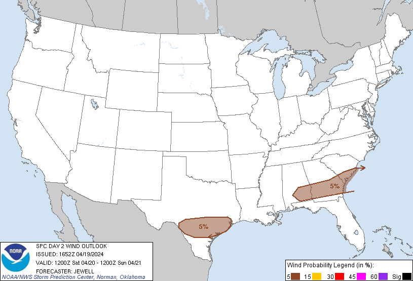
Probabilistic Damaging Wind Graphic
Probability of damaging thunderstorm winds or wind gusts of 50 knots or higher within 25 miles of a point. Hatched Area: 10% of greater probability of wind gusts 65 knots or greater within 25 miles of a point.
SPC AC 191652
Day 2 Convective Outlook
NWS Storm Prediction Center Norman OK
1152 AM CDT Fri Apr 19 2024
Valid 201200Z - 211200Z
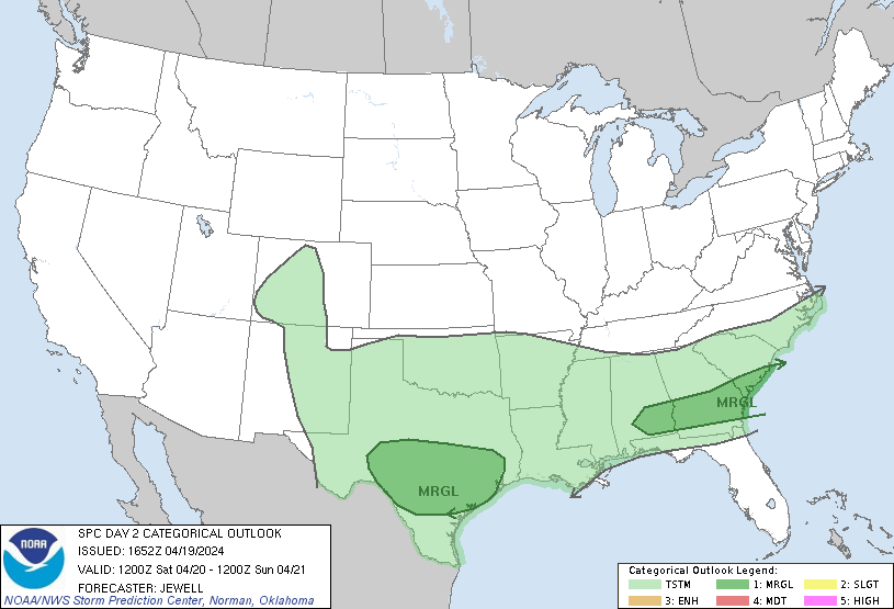
...THERE IS A MARGINAL RISK OF SEVERE THUNDERSTORMS OVER MUCH OF
CENTRAL TEXAS AND FROM SOUTHERN ALABAMA ACROSS GEORGIA AND INTO
SOUTHERN SOUTH CAROLINA...
...SUMMARY...
Marginally severe storms capable of strong wind gusts and hail will
be possible on Saturday across much of central Texas, and during the
afternoon from southern Alabama across parts of Georgia and into
southern South Carolina.
...Synopsis...
An upper trough will move east from the Great Lakes into the
Northeast, as the parent upper low deepens over Hudson Bay. Moderate
westerly flow aloft will remain from the central Plains to the East
Coast, with a low-latitude wave moving from AZ/NM across the
southern Plains through Saturday night.
At the surface, high pressure will extend south and eastward across
much of the central and eastern CONUS, with a front from the coastal
Carolinas to the northern Gulf Coast and into southern TX. A moist
air mass will remain south of this boundary in TX, where lift north
of the boundary will lead to increase rain and thunderstorms.
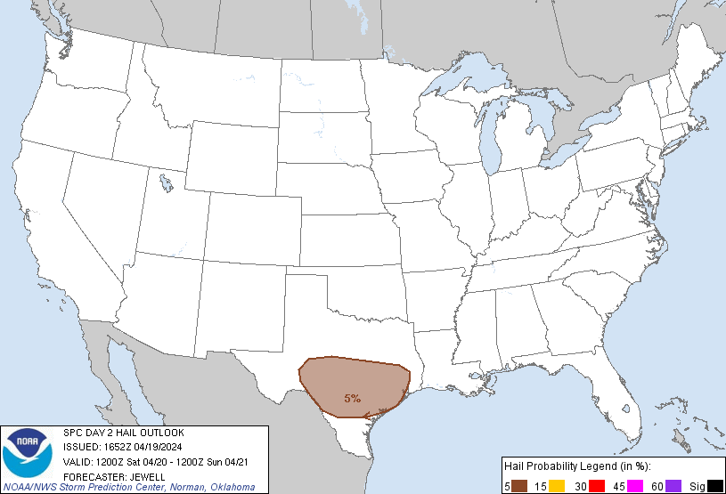
...TX...
Primarily elevated thunderstorms are likely through much of the day
over parts of central and northern TX, with activity extending east
toward northern MS. This activity will be supported by modest warm
advection just above the cool post-frontal air mass. Instability may
still be substantial, especially just north of the surface front. As
such, a few hail reports will be possible over a relatively large
area, with a conditional risk of strong gusts closer to the front.
...Coastal SC into southern GA and AL...
The surface boundary will extend roughly from coastal SC across GA
and into southern AL during the afternoon, with strong heating
expected. Although gradual drying will occur due to westerly flow,
strong heating and sufficient moisture will still result in an
unstable air mass, and eastward-moving storms producing outflow are
anticipated. Given the steep low-level lapse rates, 1000-1500 SBCAPE
and sufficient deep-layer mean winds, isolated damaging gusts will
be possible.
..Jewell.. 04/19/2024
CLICK TO GET WUUS02 PTSDY2 PRODUCT
NOTE: THE NEXT DAY 2 OUTLOOK IS SCHEDULED BY 0600Z