Probability of damaging thunderstorm winds or wind gusts of 50 knots or higher within 25 miles of a point. Hatched Area: 10% of greater probability of wind gusts 65 knots or greater within 25 miles of a point.
SPC AC 170558
Day 2 Convective Outlook
NWS Storm Prediction Center Norman OK
1258 AM CDT Wed Apr 17 2024
Valid 181200Z - 191200Z
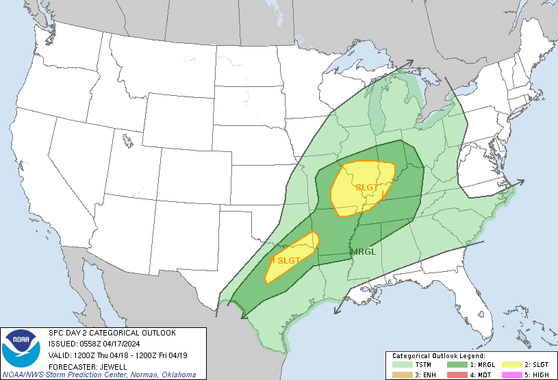
...THERE IS A SLIGHT RISK OF SEVERE THUNDERSTORMS OVER PARTS OF THE
MID MISSISSIPPI VALLEY AND LOWER OHIO VALLEY...AND OVER A PORTION OF
NORTHERN TEXAS...
...SUMMARY...
Scattered strong to severe storms capable of damaging winds, large
hail, and perhaps a couple tornadoes will be possible Thursday from
parts of eastern Missouri into the lower Ohio Valley and vicinity.
Locally damaging winds and hail are also expected over parts of
northern Texas.
...Synopsis...
On Thursday, an upper low will move east from Manitoba into western
Ontario, with a broad area of cyclonic flow aloft from the northern
Plains to the Upper Great Lakes. South of the primary midlevel
temperature gradient, moderate winds to around 50 kt will extend
southward from MO into the OH Valley, with 30 kt midlevel winds into
northern TX. Southwest winds of 30-40 kt will exist around 850 mb,
aiding theta-e advection into the Mid MS/OH Valleys.
At the surface, a cold front will exist roughly from northern MO
into northwest TX Thursday morning, with a weak low moving from MO
into the OH Valley ahead off the front. A warm front will lift
northward ahead of the low, allowing moistening to occur over much
of southern IL, IN, and northern KY during the day, and spreading
into western OH overnight. Ample moisture ahead of this front will
result in an elongated area of strong to severe potential throughout
the day.
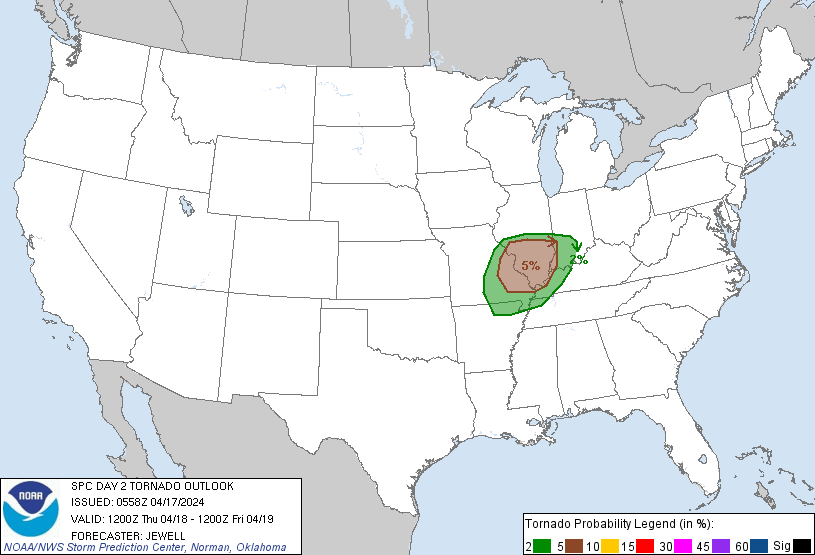
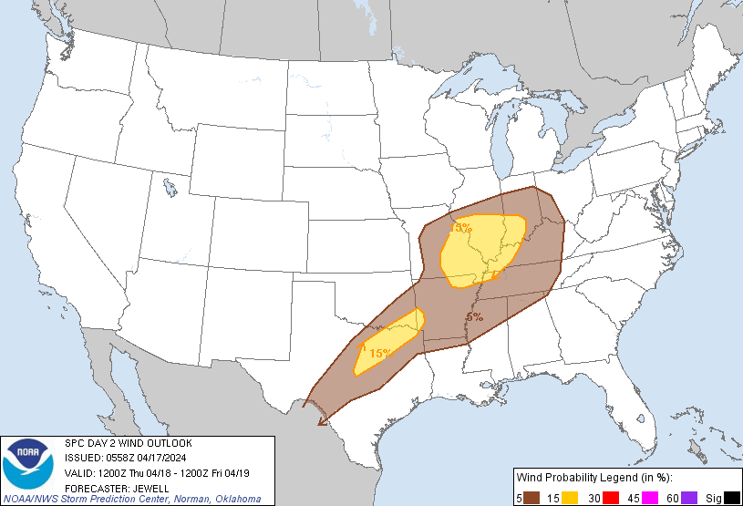
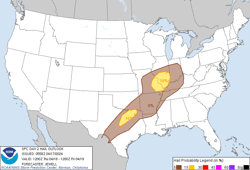
...Mid MS Valley into the lower OH Valley...
Severe probabilities have been shifted farther west given latest
model trends, as strong to severe storms could begin rather early in
the day. Ongoing areas of storms are expected on the nose of the
low-level jet, possibly in the form of an MCS, roughly over northern
MO. As the warm front lifts north ahead of any such system, this
could prove favorable for a swath of damaging winds. Otherwise,
activity is expected to form near the low and along the cold front,
where instability and shear will also favor supercells with large
hail and perhaps tornado risk. Given the potential for early storms,
this lends uncertainty to the forecast, and precludes an upgrade of
higher coverage probabilities as placement would be uncertain.
Regardless of early day evolution, moderate westerlies atop the
expanding moist sector should favor areas of damaging wind, hail,
and perhaps a few tornadoes during the day and through early
evening. The severe risk could potentially reach into western OH and
northern KY late, depending on upstream evolution.
...Northern TX...
A cold front will push quickly south across OK and MO during the
day, and across the Red River during the late afternoon and early
evening. Given the late frontal arrival, strong destabilization will
occur with full heating and upper 60s to lower 70s F dewpoints.
MLCAPE over 3000 J/kg is forecast, with steep lapse rates through a
deep layer. Although shear will not be strong, hodographs will
favor southeastward-moving cells developing near the front or within
the narrow low-level lapse rate plume where it will become uncapped.
Locally damaging downbursts along with hail will be possible with
any storms that develop, warranting an upgrade in severe
probabilities for this focused diurnal event.
..Jewell.. 04/17/2024
CLICK TO GET WUUS02 PTSDY2 PRODUCT
NOTE: THE NEXT DAY 2 OUTLOOK IS SCHEDULED BY 1730Z