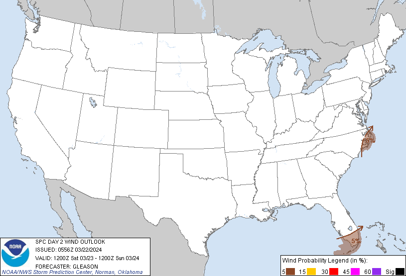
Probability of damaging thunderstorm winds or wind gusts of 50 knots or higher within 25 miles of a point. Hatched Area: 10% of greater probability of wind gusts 65 knots or greater within 25 miles of a point.
Probability of hail 1" or larger within 25 miles of a point. Hatched Area: 10% or greater probability of hail 2" or larger within 25 miles of a point.
Day 2 Hail Risk
Area (sq. mi.)
Area Pop.
Some Larger Population Centers in Risk Area
No Risk Areas Forecast
SPC AC 220556
Day 2 Convective Outlook
NWS Storm Prediction Center Norman OK
1256 AM CDT Fri Mar 22 2024
Valid 231200Z - 241200Z
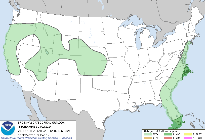
...THERE IS A MARGINAL RISK OF SEVERE THUNDERSTORMS ACROSS PARTS OF
SOUTH FLORIDA/THE KEYS...AND EASTERN NORTH CAROLINA...
...SUMMARY...
Isolated strong to severe thunderstorms may occur Saturday across
parts of south Florida and the Keys, along with eastern North
Carolina/the Outer Banks.
...Synopsis...
Two upper troughs will advance across the eastern states on
Saturday, with the southern-stream upper trough progressing over the
Southeast and eventually the western Atlantic through Saturday
evening. An initially weak surface low over GA should redevelop
along/near the Outer Banks of NC by Saturday afternoon. Multiple
surface lows will probably form through Saturday evening along the
length of a cold front given the split-flow pattern aloft and
various sources of large-scale ascent. Greater low-level moisture
should remain confined to parts of south FL and the Keys, along with
eastern NC/the Outer Banks.
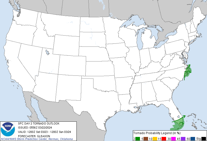
...South Florida and the Keys...
A parade of thunderstorm clusters over the Gulf of Mexico will
likely impact parts of the FL Peninsula and the Keys in the Day 1
period. This convection should tend to hamper daytime heating and
related destabilization across south FL Saturday morning as a
southern-stream upper trough moves eastward. An effective
front/convectively reinforced outflow boundary will probably be
located over the Keys/FL Straits at the start of the period. The
potential for weak to moderate instability to develop north of this
boundary remains questionable. Still, some guidance suggests this
may occur, especially if an overnight/early Saturday morning MCS
from the Day 1 time frame remains farther north towards the
east-central Gulf and central FL Peninsula.
Enhanced mid-level flow of 50-70 kt attendant to the upper trough
and related strong deep-level shear will conditionally support
robust/severe thunderstorms, should they develop across south FL and
the Keys. Isolated damaging winds appear to be the greatest threat
with any thunderstorm clusters that can persist and remain surface
based. But, sufficient low-level shear should also be present
Saturday morning to pose some risk for a tornado. This isolated
severe threat will shift quickly offshore by Saturday afternoon in
tandem with an eastward-moving cold front.
...Eastern North Carolina...
At least low 60s surface dewpoints will attempt to advance inland
across parts of eastern NC Saturday in tandem with a developing
surface low. Greater instability is generally expected to remain
offshore, but weak MLCAPE may develop over this region with filtered
daytime heating behind early-day convection. This morning convection
will be in a strongly sheared, but only modestly unstable
environment. If additional thunderstorms can form along/ahead of the
cold front, they could become strong to severe while posing an
isolated threat for damaging winds and perhaps a tornado.
..Gleason.. 03/22/2024
CLICK TO GET WUUS02 PTSDY2 PRODUCT
NOTE: THE NEXT DAY 2 OUTLOOK IS SCHEDULED BY 1730Z