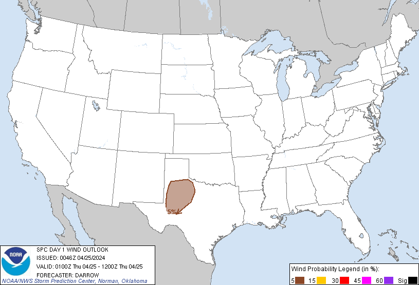
Probability of damaging thunderstorm winds or wind gusts of 50 knots or higher within 25 miles of a point. Hatched Area: 10% of greater probability of wind gusts 65 knots or greater within 25 miles of a point.
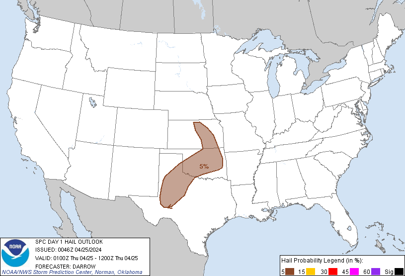
Probability of hail 1" or larger within 25 miles of a point. Hatched Area: 10% or greater probability of hail 2" or larger within 25 miles of a point.
Day 1 Hail Risk
Area (sq. mi.)
Area Pop.
Some Larger Population Centers in Risk Area
5 %
106,454
5,223,045
Oklahoma City, OK...Tulsa, OK...Wichita, KS...Lubbock, TX...Abilene, TX...
SPC AC 250046
Day 1 Convective Outlook
NWS Storm Prediction Center Norman OK
0746 PM CDT Wed Apr 24 2024
Valid 250100Z - 251200Z
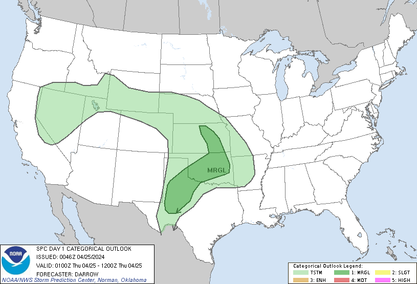
...THERE IS A MARGINAL RISK OF SEVERE THUNDERSTORMS ACROSS PORTIONS
OF THE SOUTHERN AND CENTRAL PLAINS...
...SUMMARY...
Isolated large hail and severe gusts remain possible across portions
of the southern and central Plains.
...01z Update...
Extensive mid-high cloudiness appears to be partly responsible for
the lack of deep boundary-layer cu across the TX South Plains into
the Permian Basin early this evening. While surface temperatures
warmed into the mid 80s across the Permian Basin, weak inhibition
persists across this region. 00z sounding from MAF supports this,
with a warm layer at 700mb serving as a cap for surface-based
parcels. While several HREF members suggested deep convection would
have developed by early evening, there is some concern that deep
convection may remain quite isolated, if it does develop at this
latitude. As LLJ strengthens across the High Plains tonight there
should be an increase in elevated convection farther north across
portions of OK/KS. Storms that develop due to warm advection could
generate marginally severe hail. Will maintain low severe
probabilities to account for these scenarios.
..Darrow.. 04/25/2024
CLICK TO GET WUUS01 PTSDY1 PRODUCT
NOTE: THE NEXT DAY 1 OUTLOOK IS SCHEDULED BY 0600Z