Probability of damaging thunderstorm winds or wind gusts of 50 knots or higher within 25 miles of a point. Hatched Area: 10% of greater probability of wind gusts 65 knots or greater within 25 miles of a point.
Oklahoma City, OK...Tulsa, OK...Wichita, KS...Abilene, TX...Norman, OK...
SPC AC 241937
Day 1 Convective Outlook
NWS Storm Prediction Center Norman OK
0237 PM CDT Wed Apr 24 2024
Valid 242000Z - 251200Z
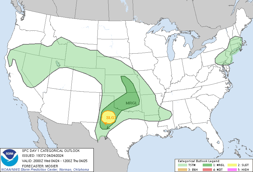
...THERE IS A SLIGHT RISK OF SEVERE THUNDERSTORMS FROM THE TEXAS
SOUTH PLAINS INTO THE PERMIAN BASIN...
...SUMMARY...
Isolated large hail and severe gusts will be possible this evening
from the Texas South Plains into the Permian Basin.
...20Z Update...
...TX South Plains into Permian Basin...
Forecast outlined in the previous discussion (appended below)
remains valid. Isolated thunderstorms still appear possible within
the destabilizing air mass from the TX South Plains into the Permian
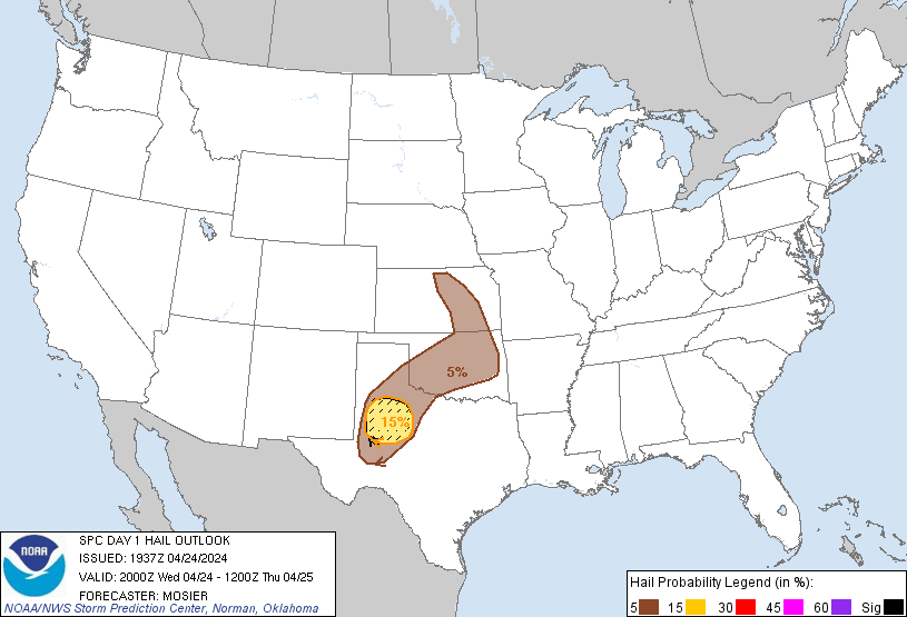
Basin. Moderate buoyancy (i.e. MLCAPE from 2000 to 2500 J/kg) and
vertical shear (i.e. 0-6 km bulk shear from 40-50 kt) support the
potential for supercells within any sustained/mature convection.
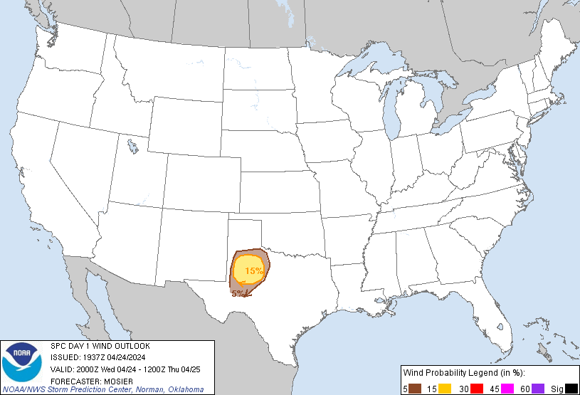
Primary risk with any supercells would be large to very large hail
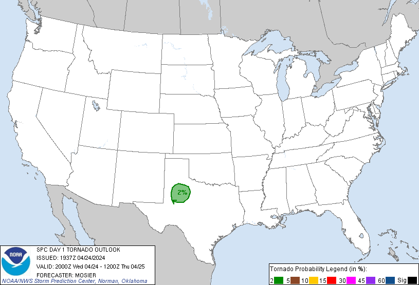
up to 2.5" in diameter and strong gusts up 70 mph. Tornado risk
still appears low, although non-zero given the increasing low-level
moisture and shear expected this evening.
...OK into Central/Eastern KS...
Thunderstorms are expected to develop tonight from central OK into
central and eastern KS as warm-air advection increases throughout
the warm sector. A few stronger storms capable of marginally severe
hail around 1" in diameter are possible through Thursday morning.
..Mosier.. 04/24/2024
.PREV DISCUSSION... /ISSUED 1120 AM CDT Wed Apr 24 2024/
...West central TX this evening...
Water-vapor imagery this morning shows a midlevel low/shortwave
trough west of the southern CA/Baja California coasts and it will
move into the lower CO Valley by tomorrow morning. A mid-level
ridge situated over the southern Rockies will gradually move east
over the southern High Plains today. A lee trough will become more
pronounced throughout the day and act to maintain southerly
low-level flow across much of TX south of a warm front. The warm
front initially analyzed this morning near the Red River will slowly
move northward. Late morning surface observations over the Permian
Basin/Concho Valley indicate low to mid 60s dewpoints. The 12z MAF
raob showed a 7.9 deg C/km 700-500 mb lapse rate, indicative of an
elevated mixed layer.
Weak forcing for ascent at best is expected beneath the mid-level
shortwave ridge, thereby limiting potential storm coverage. Despite
the associated forcing/capping concerns, convective inhibition will
erode considerably by 21-00z. Uncertainty remains regarding storm
development, but additional heating this afternoon --perhaps delayed
a bit due to considerable low cloud cover-- will result in moderate
buoyancy (2000-2500 J/kg MLCAPE). Relatively weak but veering winds
in the low levels beneath 65-kt westerly 250-mb flow will support a
conditional threat for supercells. Deeper mixing over the Permian
Basin may be enough to overcome and lead to a couple of storms by
late afternoon/early evening along the dryline. Isolated very large
hail up to 2.5 inches in diameter and severe outflow gusts of 60-70
mph are possible. There will be an increase in low-level shear this
evening and low-level moisture will be greater compared to
yesterday, so an isolated tornado will also be possible in a narrow
time window this evening before inhibition increases and storms
weaken.
...OK into KS through tonight...
Elevated thunderstorms near the OK/KS border late this morning are
likely the result of low-midlevel warm advection and weak buoyancy
rooted near 700 mb. Some of this convection could persist this
afternoon but it is uncertain whether intensification will occur
with this activity and whether a marginal hail threat develops. The
more probable risk for elevated storms will occur tonight coincident
with strengthening warm advection and increasing low-level moisture.
CLICK TO GET WUUS01 PTSDY1 PRODUCT
NOTE: THE NEXT DAY 1 OUTLOOK IS SCHEDULED BY 0100Z