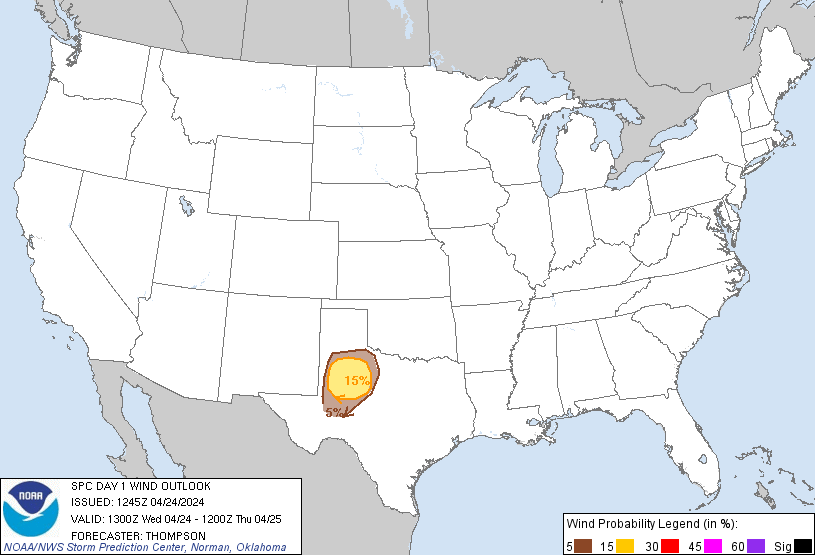
Probability of damaging thunderstorm winds or wind gusts of 50 knots or higher within 25 miles of a point. Hatched Area: 10% of greater probability of wind gusts 65 knots or greater within 25 miles of a point.
Oklahoma City, OK...Tulsa, OK...Wichita, KS...Abilene, TX...Norman, OK...
SPC AC 241245
Day 1 Convective Outlook
NWS Storm Prediction Center Norman OK
0745 AM CDT Wed Apr 24 2024
Valid 241300Z - 251200Z
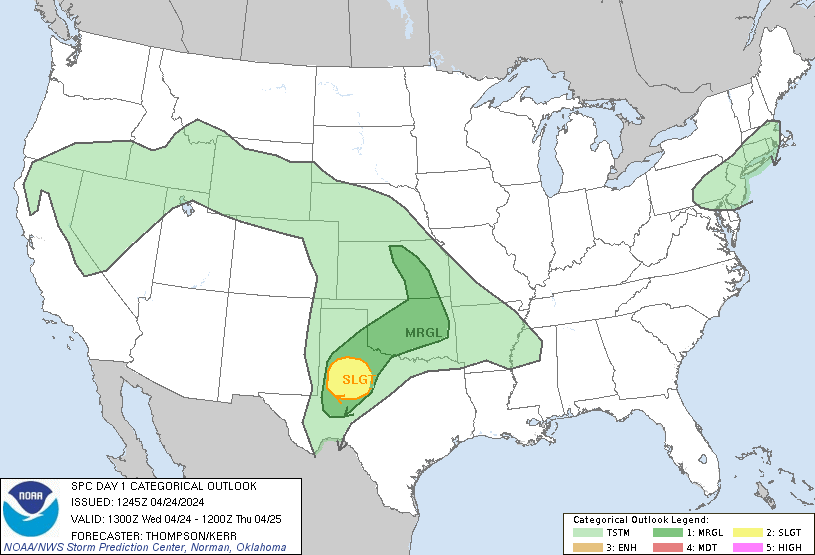
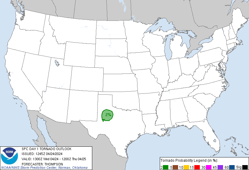
...THERE IS A SLIGHT RISK OF SEVERE THUNDERSTORMS THIS EVENING
ACROSS WEST CENTRAL TX...
...SUMMARY...
Isolated large hail and damaging winds will be possible this evening
across west central Texas.
...West central TX this evening...
A midlevel shortwave trough off the southern CA coast will move
inland over southern AZ by the end of the period. Downstream,
shortwave ridging will persist over the Plains, though some increase
in westerly flow over the Rockies will contribute to lee troughing
across eastern CO/NM. The lee trough will maintain southerly
low-level flow and a gradual increase in low-level moisture to the
south of a warm front that will move slowly northward across OK and
the TX Panhandle. The moistening (boundary-layer dewpoints of 64-70
F and 100 mb mean mixing ratios of 12-14 g/kg) will occur beneath a
warm elevated mixed layer with midlevel lapse rates of 8-9 C/km,
which will drive large buoyancy (MLCAPE > 2000 J/kg) within a capped
warm sector.
The potential exception to this is along the developing dryline
across west central TX where surface heating/mixing could be deep
enough to remove convective inhibition, and isolated thunderstorm
development will be possible by this afternoon/evening. Confidence
in storm development is modest, but the environment with large
buoyancy, steep lapse rates and effective bulk shear greater than 40
kt will conditionally favor supercells capable of producing isolated
very large hail up to 2.5 inches in diameter and severe outflow
gusts of 60-70 mph. There will be an increase in low-level shear
this evening and low-level moisture will be greater compared to
yesterday, so an isolated tornado will also be possible in a narrow
time window this evening before inhibition increases and storms
weaken.
...OK into KS through tonight...
Elevated thunderstorms are ongoing over western OK in a zone of
low-midlevel warm advection and weak buoyancy likely rooted near 700
mb. Some of this convection could persist today while spreading
eastward, with a low-end hail threat. Additional elevated storms
are expected to form overnight from northeast OK into KS with
strengthening warm advection and increasing low-level moisture. A
couple of storms could produce isolated large hail the last few
hours of the forecast period.
..Thompson/Kerr.. 04/24/2024
CLICK TO GET WUUS01 PTSDY1 PRODUCT
NOTE: THE NEXT DAY 1 OUTLOOK IS SCHEDULED BY 1630Z