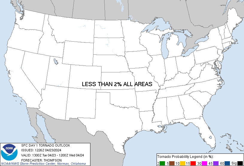
Probability of a tornado within 25 miles of a point. Hatched Area: 10% or greater probability of EF2 - EF5 tornadoes within 25 miles of a point.
Day 1 Tornado Risk
Area (sq. mi.)
Area Pop.
Some Larger Population Centers in Risk Area
No Risk Areas Forecast
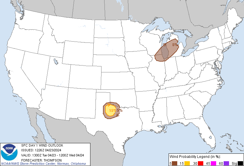
Probabilistic Damaging Wind Graphic
Probability of damaging thunderstorm winds or wind gusts of 50 knots or higher within 25 miles of a point. Hatched Area: 10% of greater probability of wind gusts 65 knots or greater within 25 miles of a point.
SPC AC 231226
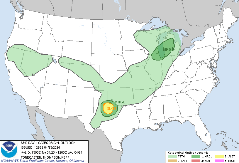
Day 1 Convective Outlook
NWS Storm Prediction Center Norman OK
0726 AM CDT Tue Apr 23 2024
Valid 231300Z - 241200Z
...THERE IS A SLIGHT RISK OF SEVERE THUNDERSTORMS LATE THIS
AFTERNOON/EVENING ACROSS NORTHWEST TX...
...SUMMARY...
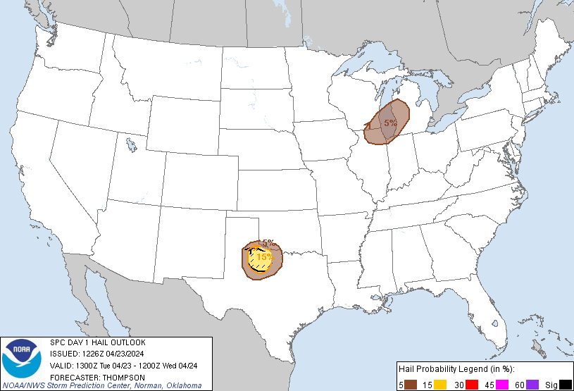
Isolated severe thunderstorms capable of producing large hail (2+
inch diameter) and gusts to 65 mph will be possible this afternoon
and evening across northwest Texas. Additional strong storms
producing hail up to 1 inch diameter and gusts up to 60 mph are
possible from southeast Wisconsin and northern Illinois into Lower
Michigan.
...Northwest TX area this afternoon/evening...
No appreciable changes to the prior outlook. In the wake of a
midlevel trough crossing the Great Lakes, a surface cold front will
move southward across KS/OK today, eventually stalling by tonight
across southeast OK and northwest TX. There will be sufficient
cross-Rockies flow aloft for lee cyclogenesis across eastern NM and
adjacent west central TX, which will maintain southerly low-level
flow and northward advection of a modifying western Gulf air mass
into the frontal zone by mid-late afternoon. Strong surface heating
along the west edge of the returning moisture will result in a
sharpening dryline by late afternoon, with a dryline/front triple
point likely just off the Caprock. Isolated thunderstorm
development will be most probable near the triple point after 21z,
and convection will subsequently move southeastward before weakening
by late evening. The storm environment will be characterized by
moderate buoyancy (MLCAPE of 1500-2000 J/kg), steep midlevel lapse
rates near 9 C/km, and sufficient deep-layer shear for supercells.
Isolated very large hail of 2-2.5 inches in diameter will be the
main threat, along with a few 55-65 mph outflow gusts.
...Northern IL/southeast WI/Lower MI late this afternoon/evening...
Only minor changes to the MRGL risk area in lower MI. A midlevel
trough over the upper MS Valley this morning will continue
east-southeastward over the Great Lakes by Wednesday morning. An
associated surface trough will likewise move southeastward, and this
trough will be preceded by a band of rain with minimal buoyancy.
Behind the rain band, surface heating with steepening low-level
lapse rates and cooling midlevel temperatures will support weak
surface-based buoyancy just ahead of a secondary frontal surge.
Some low-topped convection will be possible in this zone late this
afternoon through late evening from northern IL/southeast WI into
lower MI. The storms could pose a marginal hail/wind threat.
..Thompson/Kerr.. 04/23/2024
CLICK TO GET WUUS01 PTSDY1 PRODUCT
NOTE: THE NEXT DAY 1 OUTLOOK IS SCHEDULED BY 1630Z