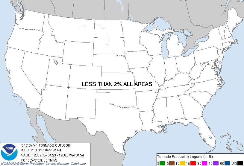
Probability of a tornado within 25 miles of a point. Hatched Area: 10% or greater probability of EF2 - EF5 tornadoes within 25 miles of a point.
Day 1 Tornado Risk
Area (sq. mi.)
Area Pop.
Some Larger Population Centers in Risk Area
No Risk Areas Forecast
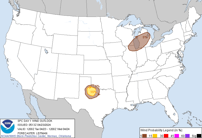
Probabilistic Damaging Wind Graphic
Probability of damaging thunderstorm winds or wind gusts of 50 knots or higher within 25 miles of a point. Hatched Area: 10% of greater probability of wind gusts 65 knots or greater within 25 miles of a point.
SPC AC 230513
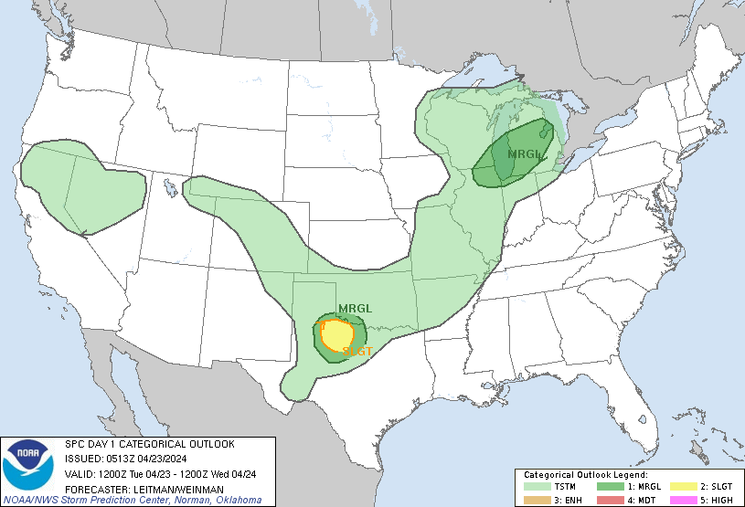
Day 1 Convective Outlook
NWS Storm Prediction Center Norman OK
1213 AM CDT Tue Apr 23 2024
Valid 231200Z - 241200Z
...THERE IS A SLIGHT RISK OF SEVERE THUNDERSTORMS ACROSS PORTIONS OF
NORTHWEST TEXAS...
...SUMMARY...
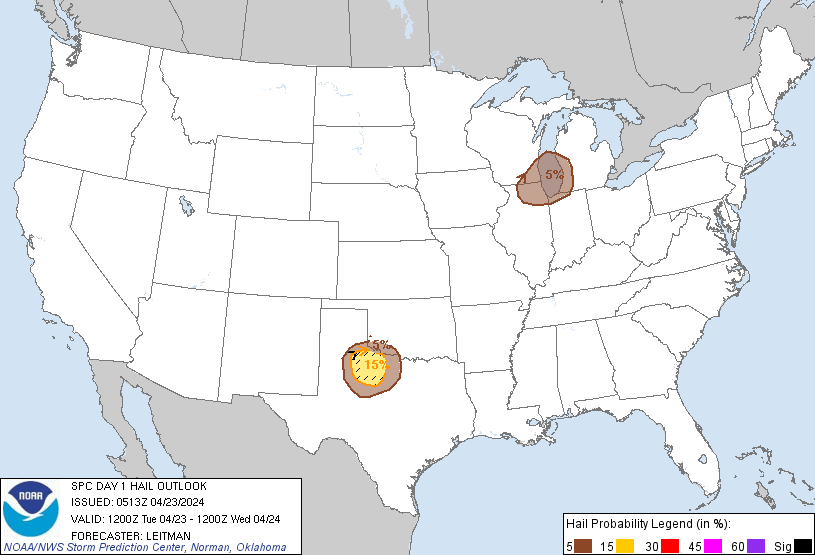
A few severe thunderstorms capable of producing large hail (2+ inch
diameter) and gusts to 65 mph will be possible this afternoon and
evening across northwest Texas. Additional strong storms producing
hail to near 1 inch diameter and 60 mph gusts are possible from
southeast Wisconsin and northern Illinois into Lower Michigan.
...Synopsis...
An upper shortwave trough will pivot eastward across the Upper Great
Lakes to the Northeast today. Meanwhile, upper ridging will be
focused over the Rockies. At the surface, an area of elongated low
pressure is forecast from Quebec to the Upper MS Valley. A secondary
surface low is forecast to develop over the TX Panhandle/South
Plains. A cold front will link between these two areas of low
pressure, extending from southwest WI to central OK and the TX
Panhandle by early/mid afternoon. A prior cold frontal intrusion
into the Gulf of Mexico and surface high pressure over the Southeast
will limit boundary-layer moisture. However, east/southeasterly
low-level trajectories into TX become more south/southwest into OK
and the along the surface trough into the Upper Great Lakes will
allow for low 60s F dewpoints south (southern Plains) to 40s F
dewpoints north (Great Lakes).
...Upper Great Lakes...
Stronger large-scale ascent will be focused across WI/Lower MI and
vicinity during the afternoon ahead of the surface front and upper
shortwave trough. While boundary-layer moisture will remain modest,
temperatures aloft are forecast to be quite cool, resulting in very
steep midlevel lapse rates. This will foster MLCAPE values generally
less than 750 J/kg amid modest effective shear magnitudes greater
than 30 kt. This should support isolated strong to severe storms
during the afternoon/evening from southeast WI into northern IL/IN
and parts of Lower MI. Elongated hodographs and mainly elevated
instability coupled with the cold temperatures aloft may support
hail to near 1 inch diameter. Steep low-level lapse rates amid a dry
boundary-layer also may support locally strong gusts.
...Northwest TX/Southwest OK vicinity...
Large-scale ascent will be somewhat nebulous over the region today,
but subtle northwest flow aloft amid veering low-level wind profiles
will result in 40+ kt effective shear magnitudes. Strong heating in
the vicinity of a surface low/triple point and dryline, coupled with
steep midlevel lapse rates, will aid in moderate destabilization
(MLCAPE around 1500-2000 J/kg possible). This should support a few
organized cells during the late afternoon/evening. Elongated
forecast hodographs and modest vertical shear through 3 km suggests
supercells capable of large hail (2+ inch diameter) are possible.
Weak low-level flow and mixing to around 850 mb also indicates some
potential for locally strong/severe gusts. While storm coverage is
expected to remain isolated, given potential for significant hail
(2+ inch diameter), a Slight (level 2 of 5) risk has been included.
..Leitman/Weinman.. 04/23/2024
CLICK TO GET WUUS01 PTSDY1 PRODUCT
NOTE: THE NEXT DAY 1 OUTLOOK IS SCHEDULED BY 1300Z