Probability of damaging thunderstorm winds or wind gusts of 50 knots or higher within 25 miles of a point. Hatched Area: 10% of greater probability of wind gusts 65 knots or greater within 25 miles of a point.
SPC AC 201950
Day 1 Convective Outlook
NWS Storm Prediction Center Norman OK
0250 PM CDT Sat Apr 20 2024
Valid 202000Z - 211200Z
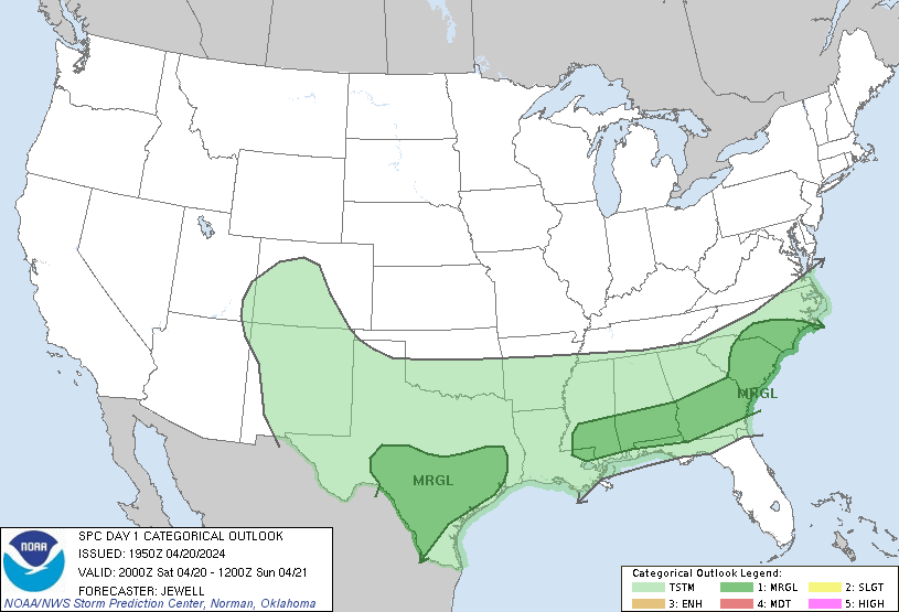
...THERE IS A MARGINAL RISK OF SEVERE THUNDERSTORMS OVER PARTS OF
THE SOUTHEAST...AND INTO CENTRAL AND SOUTHERN TEXAS...
...SUMMARY...
Marginally severe storms capable of strong wind gusts and hail will
be possible mainly this afternoon/evening across portions of central
and south Texas, and from southern Mississippi to southern North
Carolina.
No changed required for the 20Z update.
For more information see mesoscale discussion 498, 499, 500.
..Jewell.. 04/20/2024
.PREV DISCUSSION... /ISSUED 1112 AM CDT Sat Apr 20 2024/
...Synopsis...
Mid-morning radar mosaics show a broad swath of elevated convection
ongoing across the southern Plains ahead of an approaching
upper-level wave. While a few instances of gusty winds and/or
sub-severe hail will be possible with this activity, a slightly more
robust severe threat will be focused along a surface cold front
recently analyzed from the southern Appalachians to southern TX.
Surface high pressure is expected to build east into the Plains/MS
Valley through the day, which will nudge the cold front slowly
southward over the next 24 hours. Isolated to scattered
thunderstorms are expected to develop along this boundary by
mid-afternoon with a few strong/severe storms possible.
...Southern Gulf states to the Southeast...
Mostly clear to partly cloud skies are noted along and ahead of the
cold front from SC into southern AL/MS. Diurnal warming of a
modestly moist air mass should yield MLCAPE values upwards of 1000
J/kg by early to mid-afternoon. Despite minimal inhibition, weak
forcing for ascent along the front should support isolated to widely
scattered thunderstorms. Storm motions largely along the boundary
should support initial cells growing upscale into clusters through
the afternoon/evening. While low to mid-level winds are modest,
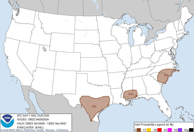
30-40 knot flow aloft may support sufficient deep-layer shear for a
few more organized cells/clusters with an attendant hail risk.
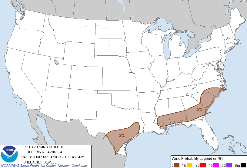
Damaging outflow gusts are also possible - especially across areas
where surface temperatures can warm into the mid/upper 80s by peak
heating. Based on 16 UTC observations, this appears most likely to
occur across parts of GA into the Carolinas.
...Southern Texas...
Two clusters of thunderstorms appear possible this afternoon and
evening across southern Texas. Elevated convection developing along
the western fringe of the synoptic front across the Big Bend region
of TX should gradually become surface-based as storms migrate east
into an increasingly buoyant air mass. Thunderstorms should also be
focused along a more subtle boundary noted along the TX Coastal
Plain in recent surface analyses. Across both regions, sufficient
deep-layer shear should be in place to support a few organized
cells, but mean storm motions and deep-layer shear vectors largely
along the initiating boundaries should favor convective clusters
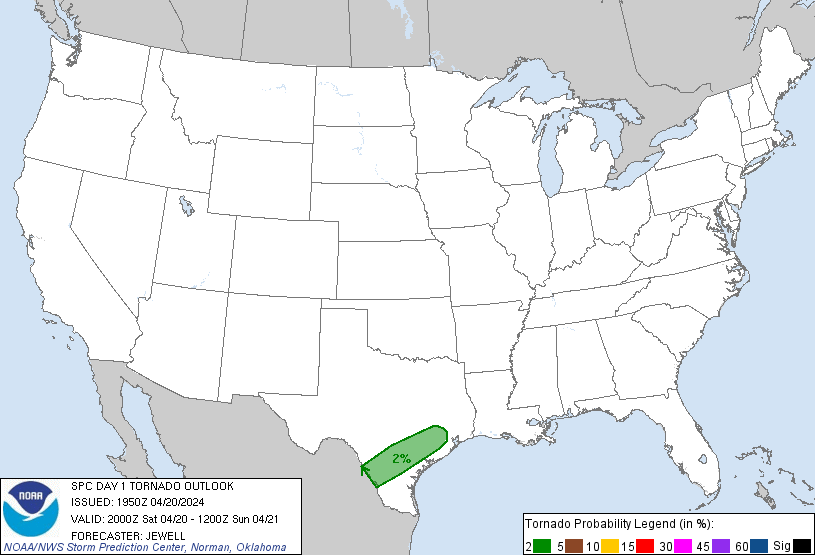
with an attendant hail/wind risk. A low-end tornado threat may
materialize along the boundary along the Coastal Plain where
low-level flow should remain backed to the south/southeast, yielding
effective SRH values between 100-150 m2/s2. However, given the
potential for upscale growth, this threat is expected to be fairly
limited.
CLICK TO GET WUUS01 PTSDY1 PRODUCT
NOTE: THE NEXT DAY 1 OUTLOOK IS SCHEDULED BY 0100Z