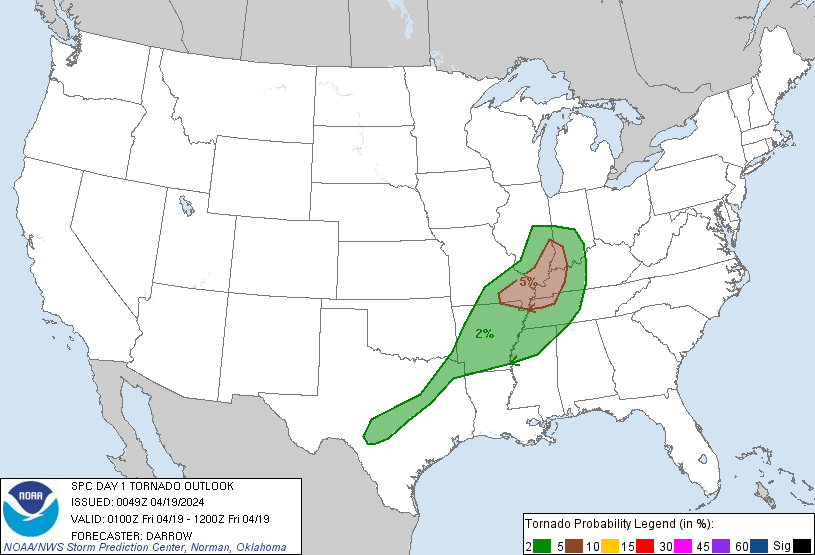
Indianapolis, IN...Memphis, TN...Nashville, TN...Louisville, KY...Little Rock, AR...
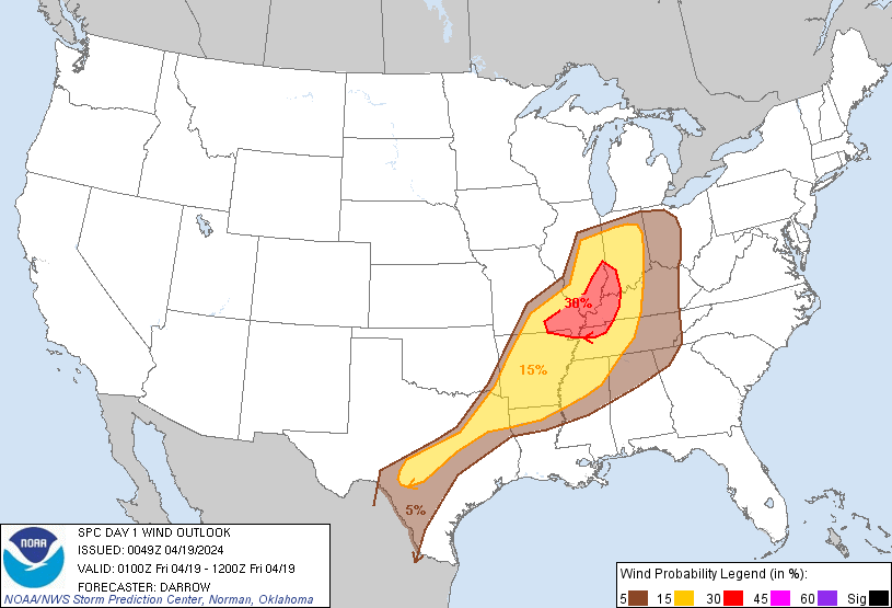
Probabilistic Damaging Wind Graphic
Probability of damaging thunderstorm winds or wind gusts of 50 knots or higher within 25 miles of a point. Hatched Area: 10% of greater probability of wind gusts 65 knots or greater within 25 miles of a point.
Memphis, TN...Shreveport, LA...Little Rock, AR...Waco, TX...Evansville, IN...
5 %
137,070
19,331,099
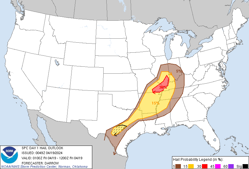
San Antonio, TX...Indianapolis, IN...Austin, TX...Nashville, TN...St. Louis, MO...
SPC AC 190049
Day 1 Convective Outlook
NWS Storm Prediction Center Norman OK
0749 PM CDT Thu Apr 18 2024
Valid 190100Z - 191200Z
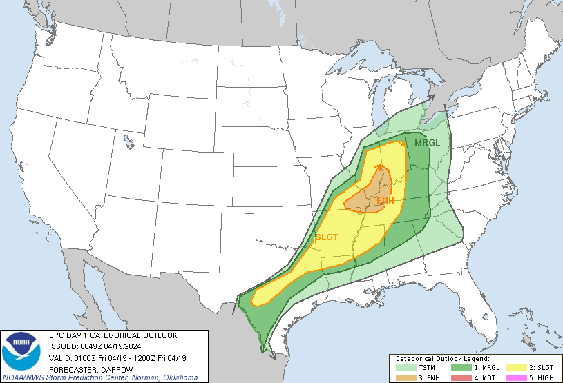
...THERE IS AN ENHANCED RISK OF SEVERE THUNDERSTORMS ACROSS PORTIONS
OF THE MIDDLE MISSISSIPPI AND LOWER OHIO VALLEYS...
...SUMMARY...
Severe thunderstorms should be most concentrated over portions of
the middle Mississippi and lower Ohio Valleys early tonight. More
isolated activity is expected farther south across Arkansas into
south-central Texas.
...01z Update...
Low-amplitude short-wave trough is currently ejecting east across
IL. This feature is forecast to advance into eastern OH by sunrise.
Large-scale support ahead of this feature is expected to encourage
ongoing MCS over the middle MS Valley to propagate downstream across
the remainder of southeast IL into southern IN later this evening.
This MCS is currently severe and has produced a variety of wind/hail
reports across MO/western IL. Current thinking is wind/hail will
continue to accompany this squall line, at least into the lower OH
Valley where it will encounter weaker buoyancy.
Surging cold front has advanced into northwest AR, arcing southwest
across southeast OK into the Edwards Plateau of southwest TX.
Thunderstorms have struggled to develop along portions of this wind
shift, but isolated robust convection is currently sagging south
through the Hill Country, just north of Llano. Very large hail may
yet accompany this activity before low-level lapse rates weaken.
Convection should remain isolated along the trailing cold front due
in large part to negligible large-scale forcing. Nocturnal cooling
should limit coverage across this region.
..Darrow.. 04/19/2024
CLICK TO GET WUUS01 PTSDY1 PRODUCT
NOTE: THE NEXT DAY 1 OUTLOOK IS SCHEDULED BY 0600Z