Probability of damaging thunderstorm winds or wind gusts of 50 knots or higher within 25 miles of a point. Hatched Area: 10% of greater probability of wind gusts 65 knots or greater within 25 miles of a point.
Day 1 Wind Risk
Area (sq. mi.)
Area Pop.
Some Larger Population Centers in Risk Area
15 %
39,194
8,081,698
Pittsburgh, PA...Akron, OH...Canton, OH...Youngstown, OH...Cuyahoga Falls, OH...
SPC AC 150054
Day 1 Convective Outlook
NWS Storm Prediction Center Norman OK
0754 PM CDT Sun Apr 14 2024
Valid 150100Z - 151200Z
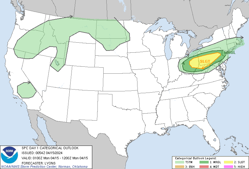
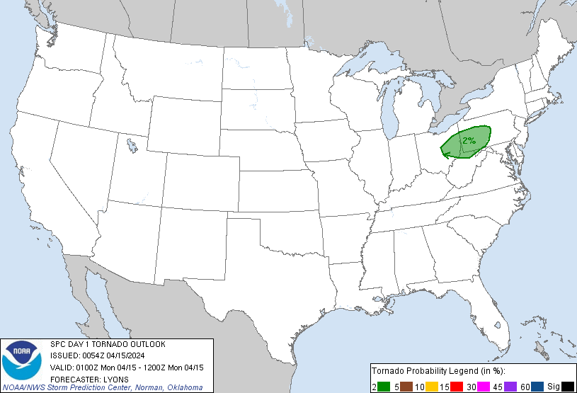
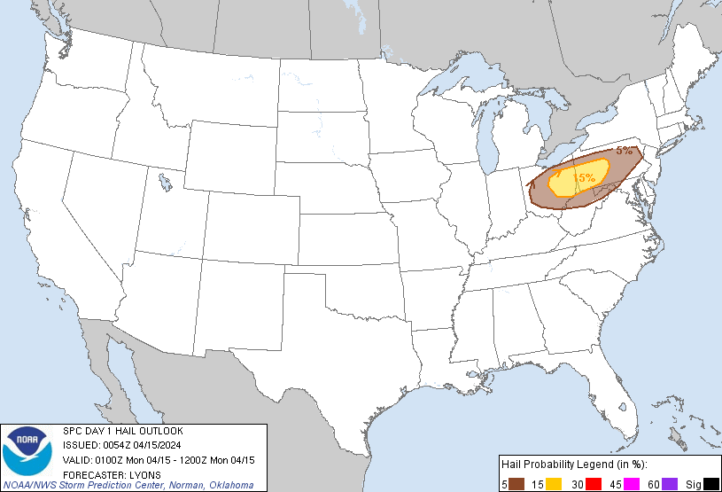
...THERE IS A SLIGHT RISK OF SEVERE THUNDERSTORMS FROM EASTERN OH
INTO NORTHERN WESTERN VIRGINIA AND CENTRAL PENNSYLVANIA...
...SUMMARY...
Severe thunderstorms across the upper Ohio Valley into Pennsylvania
and vicinity will move southward toward Virginia and the Atlantic
Coast tonight, while weakening. Damaging winds and hail should be
the main threat, though a tornado or two will remain possible this
evening.
...01z Update...
The ongoing linear cluster of storms currently located across
eastern OH into central PA have produced numerous reports of hail
and damaging winds this evening. Generally, the intensity of these
storms has decreased as diurnal heating has waned and storms have
moved into a drier environment farther south. A slow weakening trend
is expected to continue into the evening as the cold front sags
south and the air mass stabilizes. However, MUCAPE around 500 J/kg
and moderate deep-layer shear should remain sufficient for damaging
gusts and some hail, especially with storms training on the western
edge of the ongoing complex. These storms are expected to move
south, while weakening, across western/central PA and into northern
WV/VA tonight. Given the relatively high observed cloud bases, the
tornado risk is appreciably lower, though strong low-level shear may
still support a brief spin up with the more organized storms.
Storm development will remain possible along western portions of the
front and the trailing outflow into central and northeastern OH
tonight. However, confidence in storm coverage here is low owing to
modest buoyancy and forcing for ascent. Will maintain MRGL/SLGT
probabilities here for hail and damaging winds. The main update to
the outlook was to remove the Level-3 ENH, and trim higher
probabilities from the north and west where the front and convection
have moved farther south.
..Lyons.. 04/15/2024
CLICK TO GET WUUS01 PTSDY1 PRODUCT
NOTE: THE NEXT DAY 1 OUTLOOK IS SCHEDULED BY 0600Z