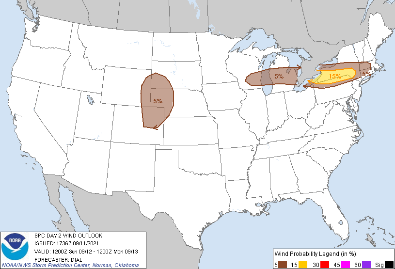
Probability of damaging thunderstorm winds or wind gusts of 50 knots or higher within 25 miles of a point. Hatched Area: 10% of greater probability of wind gusts 65 knots or greater within 25 miles of a point.
SPC AC 111736
Day 2 Convective Outlook
NWS Storm Prediction Center Norman OK
1236 PM CDT Sat Sep 11 2021
Valid 121200Z - 131200Z
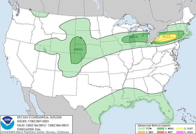
...THERE IS A SLIGHT RISK OF SEVERE THUNDERSTORMS OVER A PORTION OF
THE NORTHEAST STATES...
...SUMMARY...
Isolated strong to severe storms may occur Sunday from portions of
the Great Lakes region into the Mid-Atlantic/Northeast, and across
parts of the northern/central High Plains.
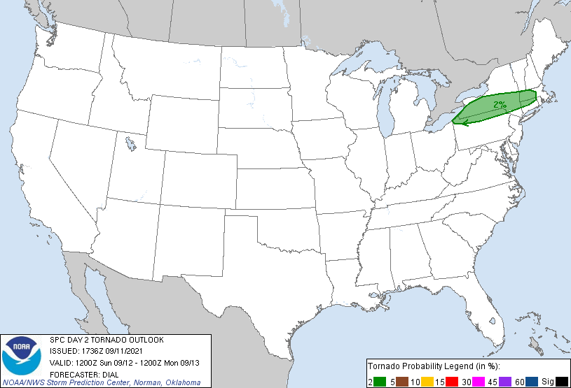
...Great Lakes through Northeast...
A low-amplitude shortwave trough embedded within a belt of stronger
westerlies will spread east through the Great Lakes during the day
and into the Northeast States Sunday evening and overnight. At the
surface a cold front will move southeast into NY and New England
during the day with the western extension of this boundary likely to
stall across southern portions of the Great Lakes region. A corridor
of moderate instability is expected to develop in vicinity of the
front and in the warm sector. The warm sector will likely remain
capped mainly across the Great Lakes region as a warm EML spreads
east. However, elevated storms are likely to develop during the
morning north of the front across a portion of lower MI. This
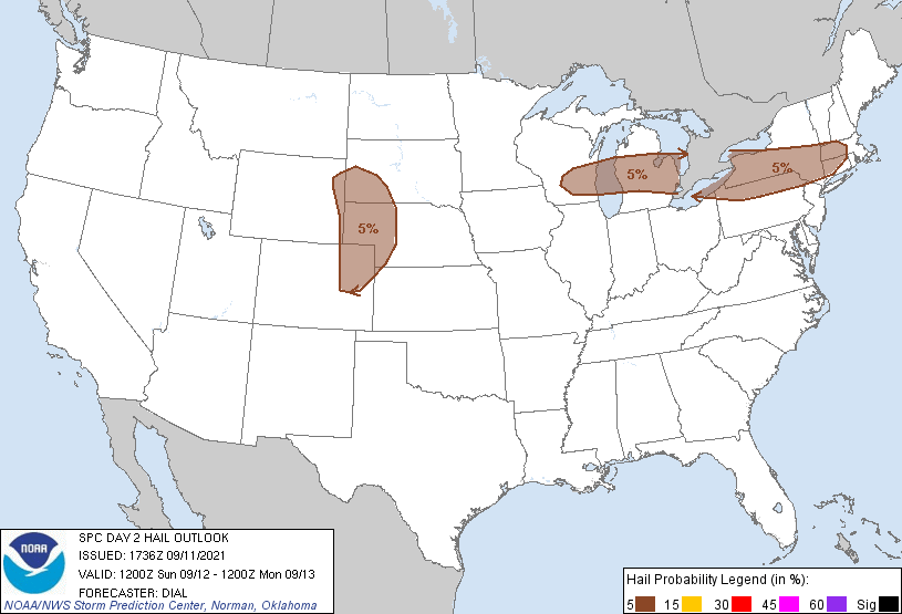
activity will be embedded within strong mid-upper flow. Steep lapse
rates and moderate instability will support some threat for large
hail, and some of the storms might also produce a few strong wind
gusts. This activity may eventually evolve into one or more small
storm clusters and become surface based as it spreads east into NY,
where strong unidirectional wind shear may support embedded
organized structures including bowing segments with damaging wind
the primary threat from late afternoon into the evening.
...Central Plains...
Much of this region will be located to the north of a weak front in
a modest low-level upslope flow regime. Low-level moisture,
characterized by generally mid 50s to low 60s surface dewpoints,
should spread westward across portions of eastern CO/WY and western
NE/SD through the day. A subtle shortwave trough with modestly
enhanced mid-level west-southwesterly flow is forecast to overspread
this region by Sunday afternoon. Large-scale ascent preceding this
feature should encourage convective development initially over the
higher terrain of the central Rockies. As storms spread eastward
during the afternoon, they will encounter greater low-level
moisture. Diurnal heating and the presence of modestly steepened
mid-level lapse rates should support 500-1500 J/kg of MLCAPE by late
Sunday afternoon. 30-40 kt deep-layer shear should foster storm
organization as convection moves eastward, with a mix of multicells
and supercells possible. Various forecast soundings across this area
show a reasonably well-mixed boundary layer, with potential for
isolated severe wind gusts with any clusters that can form. Some
large hail may also occur with supercells. These storms should
eventually weaken with eastward extent by late Sunday evening as
convective inhibition increases.
..Dial.. 09/11/2021
CLICK TO GET WUUS02 PTSDY2 PRODUCT
NOTE: THE NEXT DAY 2 OUTLOOK IS SCHEDULED BY 0600Z