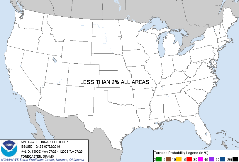
Probability of a tornado within 25 miles of a point. Hatched Area: 10% or greater probability of EF2 - EF5 tornadoes within 25 miles of a point.
Day 1 Tornado Risk
Area (sq. mi.)
Area Pop.
Some Larger Population Centers in Risk Area
No Risk Areas Forecast
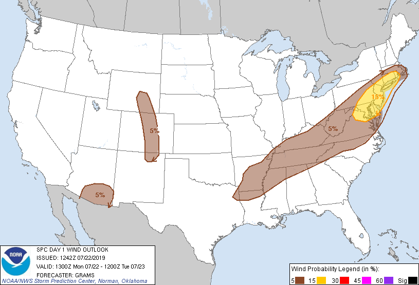
Probabilistic Damaging Wind Graphic
Probability of damaging thunderstorm winds or wind gusts of 50 knots or higher within 25 miles of a point. Hatched Area: 10% of greater probability of wind gusts 65 knots or greater within 25 miles of a point.
Day 1 Wind Risk
Area (sq. mi.)
Area Pop.
Some Larger Population Centers in Risk Area
15 %
48,625
43,513,184
New York, NY...Philadelphia, PA...Baltimore, MD...Washington, DC...Newark, NJ...
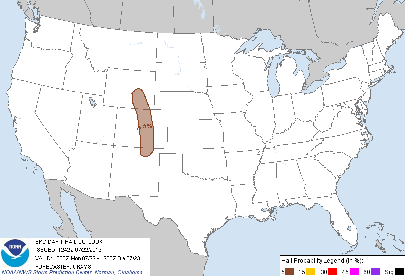
Probability of hail 1" or larger within 25 miles of a point. Hatched Area: 10% or greater probability of hail 2" or larger within 25 miles of a point.
Day 1 Hail Risk
Area (sq. mi.)
Area Pop.
Some Larger Population Centers in Risk Area
5 %
45,854
4,504,849
Denver, CO...Colorado Springs, CO...Aurora, CO...Lakewood, CO...Fort Collins, CO...
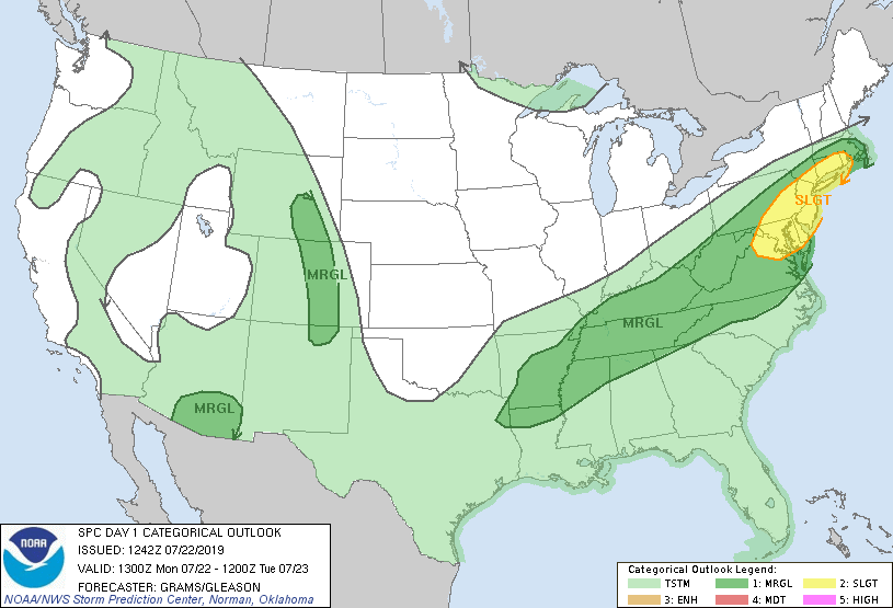
   SPC AC 221242

   Day 1 Convective Outlook
   NWS Storm Prediction Center Norman OK
   0742 AM CDT Mon Jul 22 2019

   Valid 221300Z - 231200Z

   ...THERE IS A SLIGHT RISK OF SEVERE THUNDERSTORMS PORTIONS OF THE
   MID-ATLANTIC STATES AND SOUTHERN NEW ENGLAND...

   ...SUMMARY...
   Scattered damaging winds are possible across portions of the
   Mid-Atlantic States into southern New England this afternoon to
   early evening.

   ...Mid-Atlantic States to southern New England...
   Ongoing scattered convection across the central Appalachians is
   expected to persist and intensify towards midday as ample
   boundary-layer heating occurs from the DE Valley south. However, 12Z
   soundings from Sterling, Wallops, Upton, Pittsburgh, and Wilmington
   OH all sampled mean mixing ratios about 2-3 g/kg lower compared to
   12Z yesterday, and have weaker mid-level lapse rates in the wake of
   yesterday's extensive convective overturning. This in combination
   with generally earlier storm development relative to peak late
   afternoon heating should yield a more modestly unstable air mass
   with MLCAPE around 1000-1500 J/kg. Weakening flow with height above
   500 mb, especially with southwest extent, will result in a lack of
   mid-level updraft rotation amid small hodographs. Nevertheless, an
   increasingly broad swath of 30-40 kt 700-mb will support potential
   for cold-pool dominated multicells capable of strong gusts producing
   mainly tree damage.

   ...Mid-South and TN Valley...
   Scattered thunderstorms will breakout this afternoon downstream of a
   pair of MCVs drifting along a southeast-moving cold front. Vertical
   shear across the region will be weak with only minor MCV
   enhancement. Wet microbursts yielding localized wind damage should
   be the main hazard.

   ...Southern Rockies...
   Isolated thunderstorms will be confined to the higher terrain, a few
   of which could drift into the adjacent High Plains. A belt of modest
   mid-level north/northwesterlies will persist around the Four Corners
   anticyclone, yielding some threat for marginally severe hail/wind.

   ...Southeast AZ...
   15-20 kt mid-level easterlies may help loosely organize scattered
   thunderstorms that develop over the higher terrain during the late
   afternoon. Deep inverted-v thermodynamic profiles will support a
   risk of isolated severe wind gusts until just after dusk.

   ..Grams/Gleason.. 07/22/2019

   CLICK TO GET WUUS01 PTSDY1 PRODUCT

   NOTE: THE NEXT DAY 1 OUTLOOK IS SCHEDULED BY 1630Z