Classic Supercell Photo
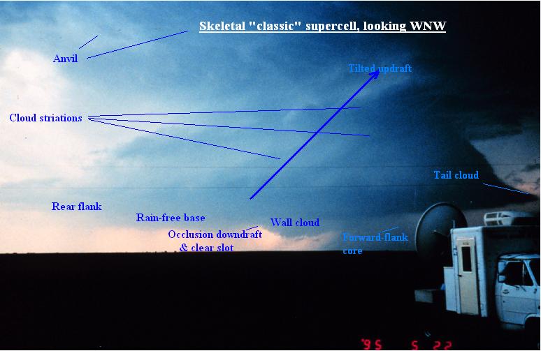
Supercells (rotating thunderstorms) nationwide are built much like this; but low clouds or precipitation often obscure the view. This storm on the high plains of the Texas Panhandle, on the other hand, illustrates most of the major features of a supercell. The funnel in the lower background dangled from a shrinking wall cloud which had produced a tornado; but a new wall cloud was forming to its east (foreground, right) as the old one occluded. This usually happens as downdraft air wraps around the circulation of the wall cloud, and evaporates cloud material to form a curved, bright, somewhat cloud-free slot. Observers can be caught off-guard if they are too close on the inflow side (usually ENE through SE) of a wall cloud, and a new one forms overhead. Also, some of the largest hail in the world falls from Great Plains supercells, much of it in the area along the edge of the forward flank core nearest the rotating updraft.